Approximate Location Map
Large Map »
Latitude: 52.4069 / 52°24'24"N
Longitude: -1.7108 / 1°42'39"W
OS Eastings: 419767
OS Northings: 278801
OS Grid: SP197788
Mapcode National: GBR 4J9.097
Mapcode Global: VHBWV.9RDR
Plus Code: 9C4WC74Q+PM
Entry Name: Arbour Farmhouse
Listing Date: 22 July 1976
Grade: II
Source: Historic England
Source ID: 1253300
English Heritage Legacy ID: 436473
ID on this website: 101253300
Location: Eastcote, Solihull, West Midlands, B92
County: Solihull
Civil Parish: Barston
Traditional County: Warwickshire
Lieutenancy Area (Ceremonial County): West Midlands
Church of England Parish: Barston
Church of England Diocese: Birmingham
Tagged with: Farmhouse
BARSTON BARSTON LANE
1.
5108
(South Side)
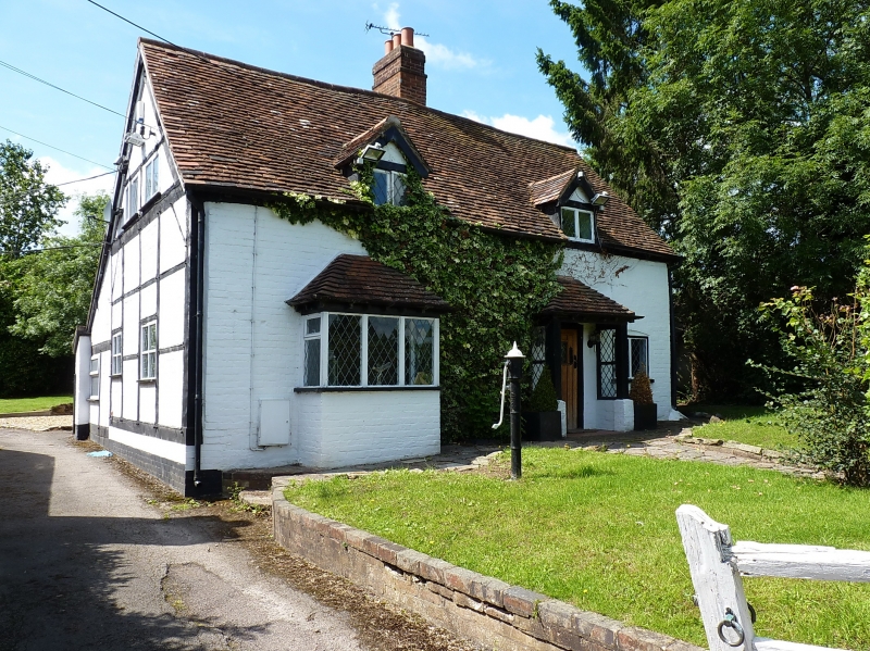
Arbour Farmhouse
SP 17 NE 3/182
II
2.
C17, altered. Colour washed brick front, timber framed side elevations. 1 storey
and attics, tiled roof. Casement windows. C17, altered C19. Red brick front,
timber framed side. Tiled roof. 1 storey and attics, casement windows.
Listing NGR: SP1976778801
External links are from the relevant listing authority and, where applicable, Wikidata. Wikidata IDs may be related buildings as well as this specific building. If you want to add or update a link, you will need to do so by editing the Wikidata entry.


Other nearby listed buildings
