Approximate Location Map
Large Map »
Latitude: 54.4894 / 54°29'21"N
Longitude: -0.6127 / 0°36'45"W
OS Eastings: 489964
OS Northings: 511339
OS Grid: NZ899113
Mapcode National: GBR SJ5J.4F
Mapcode Global: WHG9Y.KFG5
Plus Code: 9C6XF9QP+QW
Entry Name: Tate Hill Pier
Listing Date: 4 December 1972
Grade: II
Source: Historic England
Source ID: 1253727
English Heritage Legacy ID: 437024
ID on this website: 101253727
Location: Whitby, North Yorkshire, YO21
County: North Yorkshire
District: Scarborough
Civil Parish: Whitby
Built-Up Area: Whitby
Traditional County: Yorkshire
Lieutenancy Area (Ceremonial County): North Yorkshire
Church of England Parish: Whitby St Mary
Church of England Diocese: York
Tagged with: Architectural structure
1.
1811 THE PIERS
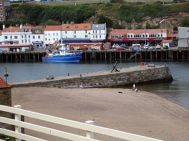
Tate Hill Pier
NZ 8911 1/7
II
2.
Formerly shown as Burgess Pier. An ancient pier enlarged in l766.
Listing NGR: NZ8996411339
External links are from the relevant listing authority and, where applicable, Wikidata. Wikidata IDs may be related buildings as well as this specific building. If you want to add or update a link, you will need to do so by editing the Wikidata entry.


Other nearby listed buildings
