Approximate Location Map
Large Map »
Latitude: 54.4895 / 54°29'22"N
Longitude: -0.6148 / 0°36'53"W
OS Eastings: 489829
OS Northings: 511341
OS Grid: NZ898113
Mapcode National: GBR SJ4J.PF
Mapcode Global: WHG9Y.JFG4
Plus Code: 9C6XF9QP+Q3
Entry Name: 23, Pier Road
Listing Date: 4 December 1972
Grade: II
Source: Historic England
Source ID: 1253829
English Heritage Legacy ID: 437105
ID on this website: 101253829
Location: Whitby, North Yorkshire, YO21
County: North Yorkshire
District: Scarborough
Civil Parish: Whitby
Built-Up Area: Whitby
Traditional County: Yorkshire
Lieutenancy Area (Ceremonial County): North Yorkshire
Church of England Parish: Whitby St Mary
Church of England Diocese: York
Tagged with: Building
1.
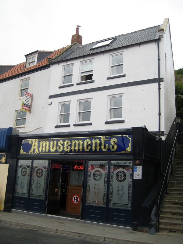
1811 PIER ROAD
No 23
NZ 8911 1/440
II GV
2.
C18 origin. 3 storeys. Rendered. Welsh slate roof. One flat topped darner,
sliding sash. 5 windows, wood frames, flat arches, no glazing bars. Bands
between storeys. Modern ground floor built out. Rear elevation to The
Cragg of 2 storeys. Included for group value.
Nos 4 to 23 (consec) form a group.
Listing NGR: NZ8982911341
External links are from the relevant listing authority and, where applicable, Wikidata. Wikidata IDs may be related buildings as well as this specific building. If you want to add or update a link, you will need to do so by editing the Wikidata entry.


Other nearby listed buildings
