Approximate Location Map
Large Map »
Latitude: 54.481 / 54°28'51"N
Longitude: -0.611 / 0°36'39"W
OS Eastings: 490089
OS Northings: 510404
OS Grid: NZ900104
Mapcode National: GBR SJ5M.HG
Mapcode Global: WHG9Y.LM7N
Plus Code: 9C6XF9JQ+9H
Entry Name: Old Bridge to West of Spital Bridge
Listing Date: 4 December 1972
Grade: II
Source: Historic England
Source ID: 1254215
English Heritage Legacy ID: 437556
ID on this website: 101254215
Location: Fishburn Park, North Yorkshire, YO22
County: North Yorkshire
District: Scarborough
Civil Parish: Whitby
Built-Up Area: Whitby
Traditional County: Yorkshire
Lieutenancy Area (Ceremonial County): North Yorkshire
Church of England Parish: Whitby St Mary
Church of England Diocese: York
Tagged with: Bridge
1.
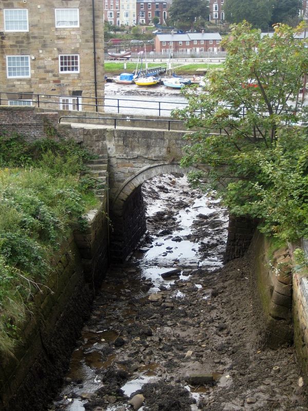
1811 SPITAL BRIDGE
Old Bridge to West of
Spital Bridge
NZ 9010 9/193
II
2.
Cl8. Single round arched stone bridge with solid parapet.
Listing NGR: NZ9008910404
External links are from the relevant listing authority and, where applicable, Wikidata. Wikidata IDs may be related buildings as well as this specific building. If you want to add or update a link, you will need to do so by editing the Wikidata entry.


Other nearby listed buildings
