Approximate Location Map
Large Map »
Latitude: 52.7086 / 52°42'31"N
Longitude: -2.7552 / 2°45'18"W
OS Eastings: 349071
OS Northings: 312598
OS Grid: SJ490125
Mapcode National: GBR BJ.2GC5
Mapcode Global: WH8BT.N56T
Plus Code: 9C4VP65V+FW
Entry Name: 68, Mardol
Listing Date: 10 January 1953
Grade: II
Source: Historic England
Source ID: 1254620
English Heritage Legacy ID: 457596
ID on this website: 101254620
Location: Shrewsbury, Shropshire, SY1
County: Shropshire
Civil Parish: Shrewsbury
Built-Up Area: Shrewsbury
Traditional County: Shropshire
Lieutenancy Area (Ceremonial County): Shropshire
Church of England Parish: Shrewsbury St Chad
Church of England Diocese: Lichfield
Tagged with: Building
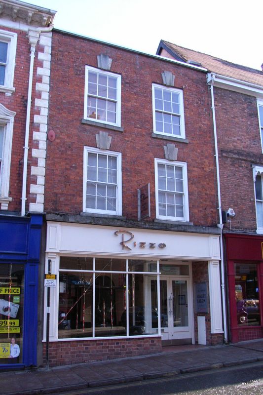
SHREWSBURY
SJ4912NW MARDOL
653-1/11/417 (North East side)
10/01/53 No.68
II
Shop, possibly formerly dwelling. Late C18. Brick with roof
not seen behind parapet eaves. 3 storeys, 2-window range with
inserted shop front and 12-pane flush-framed sash windows
above with flat-arched gauged brick heads with stressed stone
keys.
Listing NGR: SJ4907112598
External links are from the relevant listing authority and, where applicable, Wikidata. Wikidata IDs may be related buildings as well as this specific building. If you want to add or update a link, you will need to do so by editing the Wikidata entry.


Other nearby listed buildings
