Approximate Location Map
Large Map »
Latitude: 51.6417 / 51°38'29"N
Longitude: -1.8561 / 1°51'22"W
OS Eastings: 410051
OS Northings: 193660
OS Grid: SU100936
Mapcode National: GBR 3S1.5JL
Mapcode Global: VHB2Z.SZ3W
Plus Code: 9C3WJ4RV+MG
Entry Name: K6 Telephone Kiosk
Listing Date: 16 March 1992
Grade: II
Source: Historic England
Source ID: 1255497
English Heritage Legacy ID: 459783
ID on this website: 101255497
Location: Cricklade, Wiltshire, SN6
County: Wiltshire
Civil Parish: Cricklade
Built-Up Area: Cricklade
Traditional County: Wiltshire
Lieutenancy Area (Ceremonial County): Wiltshire
Church of England Parish: Cricklade
Church of England Diocese: Bristol
Tagged with: K6 telephone box
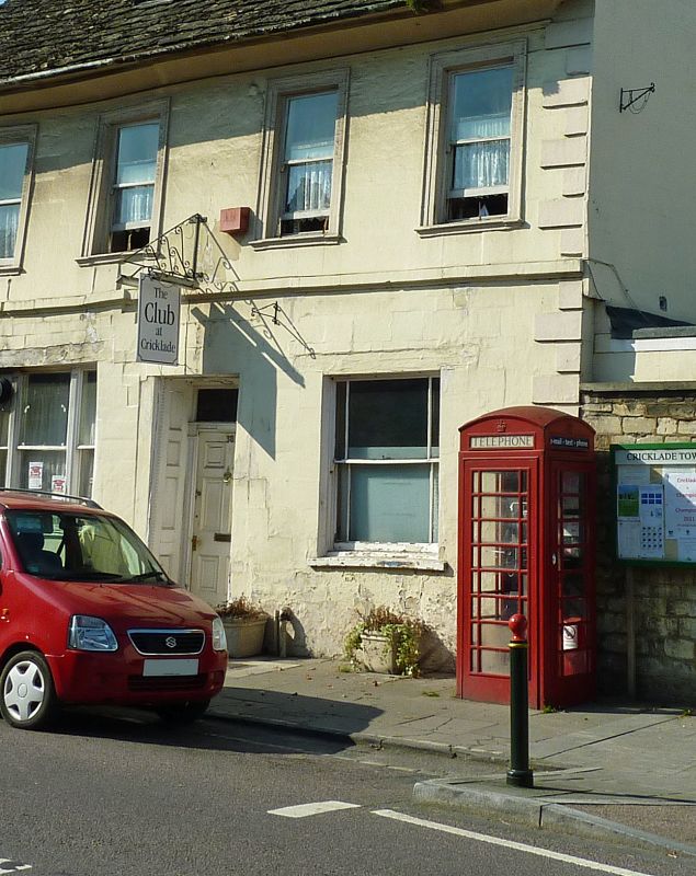
SU 19 SW CRICKLADE HIGH STREET
1178/13/10000
K6 Telephone Kiosk
GV
II
Telephone kiosk, Type K6. Designed 1935 by Sir Giles Gilbert
Scott. Made by various contractors. Cast iron. Square kiosk with
domed roof. Unperforated crowns to top panels and margin glazing to
windows and doors.
Listing NGR: SU1004593648
External links are from the relevant listing authority and, where applicable, Wikidata. Wikidata IDs may be related buildings as well as this specific building. If you want to add or update a link, you will need to do so by editing the Wikidata entry.


Other nearby listed buildings
