Approximate Location Map
Large Map »
Latitude: 54.4042 / 54°24'15"N
Longitude: -1.7394 / 1°44'21"W
OS Eastings: 417016
OS Northings: 501002
OS Grid: NZ170010
Mapcode National: GBR JK9H.7Z
Mapcode Global: WHC6D.7KZJ
Plus Code: 9C6WC736+M7
Entry Name: 9, Rosemary Lane
Listing Date: 15 October 1973
Grade: II
Source: Historic England
Source ID: 1260726
English Heritage Legacy ID: 439594
ID on this website: 101260726
Location: Richmond, North Yorkshire, DL10
County: North Yorkshire
District: Richmondshire
Civil Parish: Richmond
Built-Up Area: Richmond
Traditional County: Yorkshire
Lieutenancy Area (Ceremonial County): North Yorkshire
Church of England Parish: Richmond with Holy Trinity with Hudswell
Church of England Diocese: Leeds
Tagged with: Building
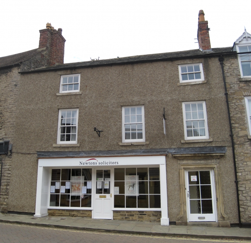
1. ROSEMARY LANE
1549 (West Side)
No 9
NZ 1701 SW 3/411
II GV
2.
Late C18, now rough rendered, stone slate roof. Three storeys. Two
windows, no glazing bars. Stone doorcase with moulded jambs, fluted frieze
end cornice. Stone plinth.
Nos 9 to 13 (odd) form a group with No 11 and Rosemary Cottage, Victoria
Road
Listing NGR: NZ1701601002
External links are from the relevant listing authority and, where applicable, Wikidata. Wikidata IDs may be related buildings as well as this specific building. If you want to add or update a link, you will need to do so by editing the Wikidata entry.


Other nearby listed buildings
