Approximate Location Map
Large Map »
Latitude: 51.0063 / 51°0'22"N
Longitude: -2.1939 / 2°11'37"W
OS Eastings: 386493
OS Northings: 123010
OS Grid: ST864230
Mapcode National: GBR 1XH.XV4
Mapcode Global: FRA 669G.73D
Plus Code: 9C3V2R44+GF
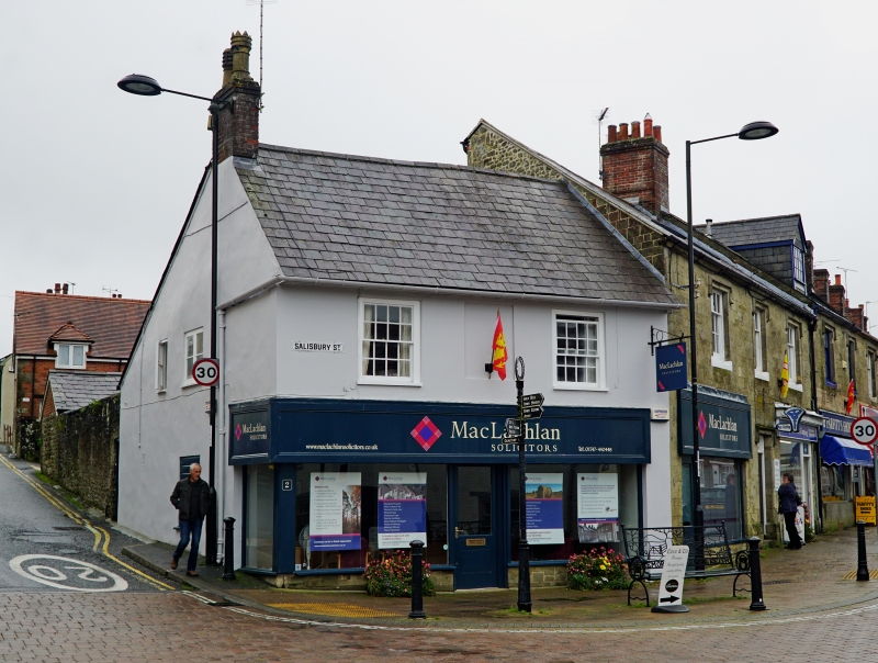
Entry Name: 2, Salisbury Street
Listing Date: 15 October 1973
Grade: II
Source: Historic England
Source ID: 1261234
English Heritage Legacy ID: 438066
ID on this website: 101261234
Location: Shaftesbury, Dorset, SP7
County: Dorset
Civil Parish: Shaftesbury
Built-Up Area: Shaftesbury
Traditional County: Dorset
Lieutenancy Area (Ceremonial County): Dorset
Church of England Parish: Shaftesbury St Peter
Church of England Diocese: Salisbury
Tagged with: Building
1.
1615 SALISBURY STREET
(North-East Side)
ST 8623 1/241 No 2
II
2.
C19 cottage. 2 storeys. 3 windows; centre 1st floor window blocked,
Slate gabled roof. Stuccoed front. Windows 4 panes wide with frames;
arge plate glass shop front on ground floor.
Listing NGR: ST8649323010
External links are from the relevant listing authority and, where applicable, Wikidata. Wikidata IDs may be related buildings as well as this specific building. If you want to add or update a link, you will need to do so by editing the Wikidata entry.


Other nearby listed buildings
