Approximate Location Map
Large Map »
Latitude: 54.4928 / 54°29'34"N
Longitude: -0.6118 / 0°36'42"W
OS Eastings: 490013
OS Northings: 511721
OS Grid: NZ900117
Mapcode National: GBR SJ5H.B6
Mapcode Global: WHG9Y.KBWK
Plus Code: 9C6XF9VQ+47
Entry Name: East Pier Lighthouse
Listing Date: 4 December 1972
Grade: II
Source: Historic England
Source ID: 1261631
English Heritage Legacy ID: 437029
Also known as: Whitby East Pier Light
ID on this website: 101261631
Location: Whitby, North Yorkshire, YO22
County: North Yorkshire
District: Scarborough
Civil Parish: Whitby
Built-Up Area: Whitby
Traditional County: Yorkshire
Lieutenancy Area (Ceremonial County): North Yorkshire
Church of England Parish: Whitby St Mary
Church of England Diocese: York
Tagged with: Lighthouse
1.
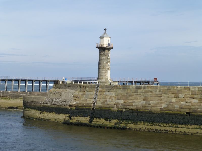
1811 THE PIERS
East Pier Lighthouse
NZ 9011 5/428
II
2.
Built 1854. Stone column shorter than that of the West Pier Lighthouse
surmounted by lantern with leaded dome. Now disused.
Listing NGR: NZ9001311721
External links are from the relevant listing authority and, where applicable, Wikidata. Wikidata IDs may be related buildings as well as this specific building. If you want to add or update a link, you will need to do so by editing the Wikidata entry.


Other nearby listed buildings
