Approximate Location Map
Large Map »
Latitude: 50.826 / 50°49'33"N
Longitude: -0.3924 / 0°23'32"W
OS Eastings: 513323
OS Northings: 104172
OS Grid: TQ133041
Mapcode National: GBR HMG.3MD
Mapcode Global: FRA B62X.6ZK
Plus Code: 9C2XRJG5+C2
Entry Name: The Hollies
Listing Date: 11 October 1949
Grade: II
Source: Historic England
Source ID: 1263310
English Heritage Legacy ID: 432650
ID on this website: 101263310
Location: West Tarring, Worthing, West Sussex, BN14
County: West Sussex
District: Worthing
Electoral Ward/Division: Tarring
Parish: Non Civil Parish
Built-Up Area: Worthing
Traditional County: Sussex
Lieutenancy Area (Ceremonial County): West Sussex
Church of England Parish: West Tarring St Andrew
Church of England Diocese: Chichester
Tagged with: Architectural structure
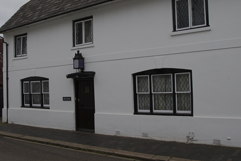
HIGH STREET
1.
5406
(East Side)
West Tarring
No 42 (The Hollies)
TQ 1304 SW 15/67 11.10.49.
II
2.
C18. 2 storeys, 3 windows. Cobbles with red brick dressings. Eaves cornice.
Round-headed doorway in frame. L shaped building behind.
Listing NGR: TQ1332304172
External links are from the relevant listing authority and, where applicable, Wikidata. Wikidata IDs may be related buildings as well as this specific building. If you want to add or update a link, you will need to do so by editing the Wikidata entry.


Other nearby listed buildings
