Approximate Location Map
Large Map »
Latitude: 53.3906 / 53°23'26"N
Longitude: -1.1096 / 1°6'34"W
OS Eastings: 459312
OS Northings: 388567
OS Grid: SK593885
Mapcode National: GBR NYP7.K8
Mapcode Global: WHDDV.X1SH
Plus Code: 9C5W9VRR+65
Entry Name: Wall Extending 60 Metres Along the South and 20 Metres Along the East Fronts of Manor Farmhouse
Listing Date: 12 January 1985
Grade: II
Source: Historic England
Source ID: 1266806
English Heritage Legacy ID: 420561
ID on this website: 101266806
Location: Oldcotes, Bassetlaw, Nottinghamshire, S81
County: Nottinghamshire
District: Bassetlaw
Civil Parish: Styrrup with Oldcotes
Built-Up Area: Oldcotes
Traditional County: Nottinghamshire
Lieutenancy Area (Ceremonial County): Nottinghamshire
Church of England Parish: Langold with Oldcotes
Church of England Diocese: Southwell and Nottingham
Tagged with: Wall
SK 58 NE
2/159
STYRRUP WITH OLDCOTES
BLYTH ROAD
Oldcotes
(North side)
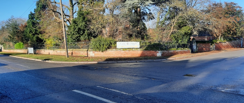
Wall extending 60 metres along the south and 20 metres along the east fronts of Manor Farmhouse
G.V.
II
Wall, gate piers and gates. c.1855. Red brick, ashlar and cast
iron. Low red brick wall, extending 80 metres along the south
and west of Manor Farmhouse, with triangular shaped ashlar coping
and decorative iron railings. Broken at the south west by a pair
of ashlar piers with shaped coping and large, single, decorative
iron gate. At this point the wall rises to meet the piers. To
the north east the wall terminates in a similar set of piers and
gate. Included for group value only.
Listing NGR: SK5931288567
External links are from the relevant listing authority and, where applicable, Wikidata. Wikidata IDs may be related buildings as well as this specific building. If you want to add or update a link, you will need to do so by editing the Wikidata entry.


Other nearby listed buildings
