Approximate Location Map
Large Map »
Latitude: 53.6036 / 53°36'12"N
Longitude: -1.9418 / 1°56'30"W
OS Eastings: 403949
OS Northings: 411893
OS Grid: SE039118
Mapcode National: GBR GVWR.DY
Mapcode Global: WHB91.4PL8
Plus Code: 9C5WJ335+C7
Entry Name: Aqueduct and Weir
Listing Date: 11 July 1985
Grade: II
Source: Historic England
Source ID: 1266900
English Heritage Legacy ID: 420300
ID on this website: 101266900
Location: Marsden, Kirklees, West Yorkshire, HD7
County: Kirklees
Electoral Ward/Division: Colne Valley
Parish: Non Civil Parish
Traditional County: Yorkshire
Lieutenancy Area (Ceremonial County): West Yorkshire
Church of England Parish: Marsden St Bartholomew
Church of England Diocese: Leeds
Tagged with: Aqueduct
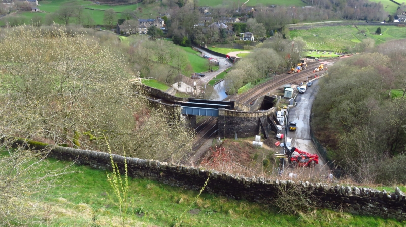
SE 0391 19 TUNNEL END
Marsden
4/472
Aqueduct and Weir
-
GV II
c.1900. Coursed rock-faced stone walls, buttresses and parapets. Large dressed
stone copings. Rounded weirs of stone. Riveted steel panels form aqueduct over
two-track railway.
Listing NGR: SE0394911893
External links are from the relevant listing authority and, where applicable, Wikidata. Wikidata IDs may be related buildings as well as this specific building. If you want to add or update a link, you will need to do so by editing the Wikidata entry.


Other nearby listed buildings
