Approximate Location Map
Large Map »
Latitude: 50.7241 / 50°43'26"N
Longitude: -3.5259 / 3°31'33"W
OS Eastings: 292388
OS Northings: 92724
OS Grid: SX923927
Mapcode National: GBR P1.8TGV
Mapcode Global: FRA 37H5.B6C
Plus Code: 9C2RPFFF+MJ
Entry Name: Southernhay Congregational Church
Listing Date: 18 June 1974
Grade: II
Source: Historic England
Source ID: 1267089
English Heritage Legacy ID: 419724
ID on this website: 101267089
Location: Barnfield, Exeter, Devon, EX1
County: Devon
District: Exeter
Electoral Ward/Division: St David's
Parish: Non Civil Parish
Built-Up Area: Exeter
Traditional County: Devon
Lieutenancy Area (Ceremonial County): Devon
Church of England Parish: Exeter St Matthew, Newtown
Church of England Diocese: Exeter
Tagged with: Church building
SOUTHERNHAY EAST
1092
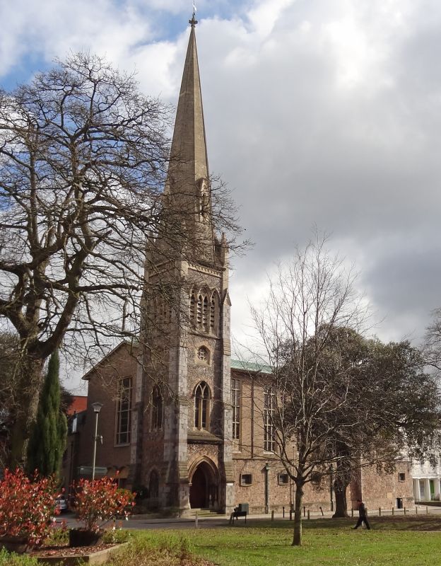
Southernhay Congregational Church
SX 9292 NW 3/1160
II
2.
1868, by Tarring. Only the tower and spire remain, the rest is modern. (1956).
Three stage limestone rubble tower with dressed corner buttresses. Octagonal spire.
Scenic value.
Listing NGR: SX9238292738
External links are from the relevant listing authority and, where applicable, Wikidata. Wikidata IDs may be related buildings as well as this specific building. If you want to add or update a link, you will need to do so by editing the Wikidata entry.


Other nearby listed buildings
