Approximate Location Map
Large Map »
Latitude: 51.5858 / 51°35'8"N
Longitude: -2.0983 / 2°5'53"W
OS Eastings: 393287
OS Northings: 187440
OS Grid: ST932874
Mapcode National: GBR 2QZ.JBN
Mapcode Global: VH95S.LD2P
Plus Code: 9C3VHWP2+8M
Entry Name: Abbey Bridge
Listing Date: 1 July 1976
Last Amended: 19 July 1996
Grade: II
Source: Historic England
Source ID: 1269294
English Heritage Legacy ID: 460916
ID on this website: 101269294
Location: Malmesbury, Wiltshire, SN16
County: Wiltshire
Civil Parish: Malmesbury
Built-Up Area: Malmesbury
Traditional County: Wiltshire
Lieutenancy Area (Ceremonial County): Wiltshire
Church of England Parish: Malmesbury and Brokenborough
Church of England Diocese: Bristol
Tagged with: Bridge
MALMESBURY
ST9387 MILL LANE
758-1/2/258 Abbey Bridge
01/07/76
(Formerly Listed as:
MILL LANE
Abbey Mill Bridge)
II
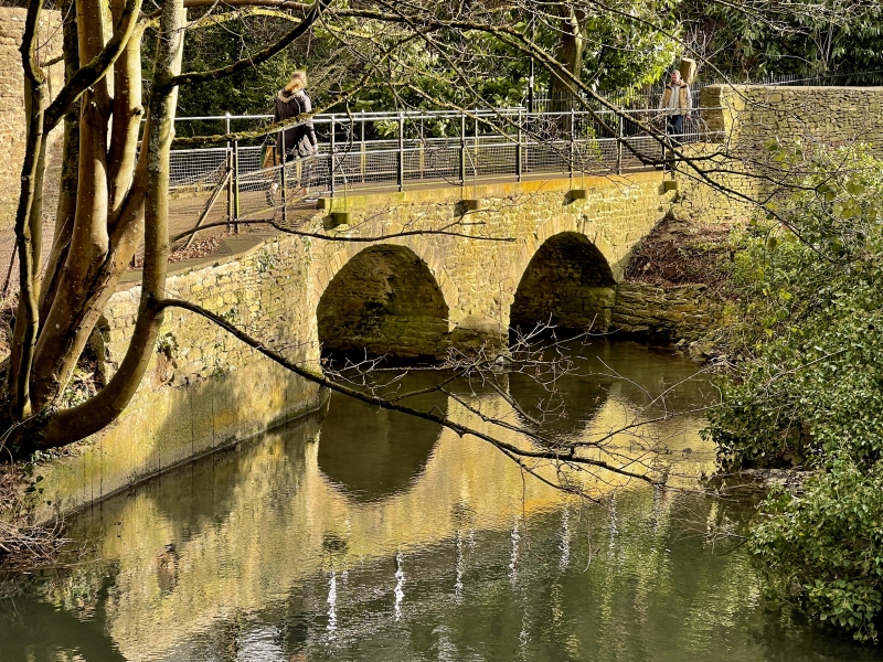
Packhorse bridge. C18. Limestone rubble and dressings. A pair
of segmental arches with voussoirs; abutments, W cutwater and
projecting blocks to support C20 rail.
Listing NGR: ST9328787440
External links are from the relevant listing authority and, where applicable, Wikidata. Wikidata IDs may be related buildings as well as this specific building. If you want to add or update a link, you will need to do so by editing the Wikidata entry.


Other nearby listed buildings
