Approximate Location Map
Large Map »
Latitude: 52.7054 / 52°42'19"N
Longitude: -2.735 / 2°44'6"W
OS Eastings: 350433
OS Northings: 312227
OS Grid: SJ504122
Mapcode National: GBR BK.2MC7
Mapcode Global: WH8BT.Y8S8
Plus Code: 9C4VP747+5X
Entry Name: Mile Post at Junction with Bell Lane
Listing Date: 17 November 1995
Grade: II
Source: Historic England
Source ID: 1271366
English Heritage Legacy ID: 455066
ID on this website: 101271366
Location: Cherry Orchard, Shropshire, SY2
County: Shropshire
Civil Parish: Shrewsbury
Built-Up Area: Shrewsbury
Traditional County: Shropshire
Lieutenancy Area (Ceremonial County): Shropshire
Church of England Parish: Shrewsbury St Giles with Sutton
Church of England Diocese: Lichfield
Tagged with: Milestone
SHREWSBURY
SJ5012SW ABBEY FOREGATE
653-1/17/68 (North side)
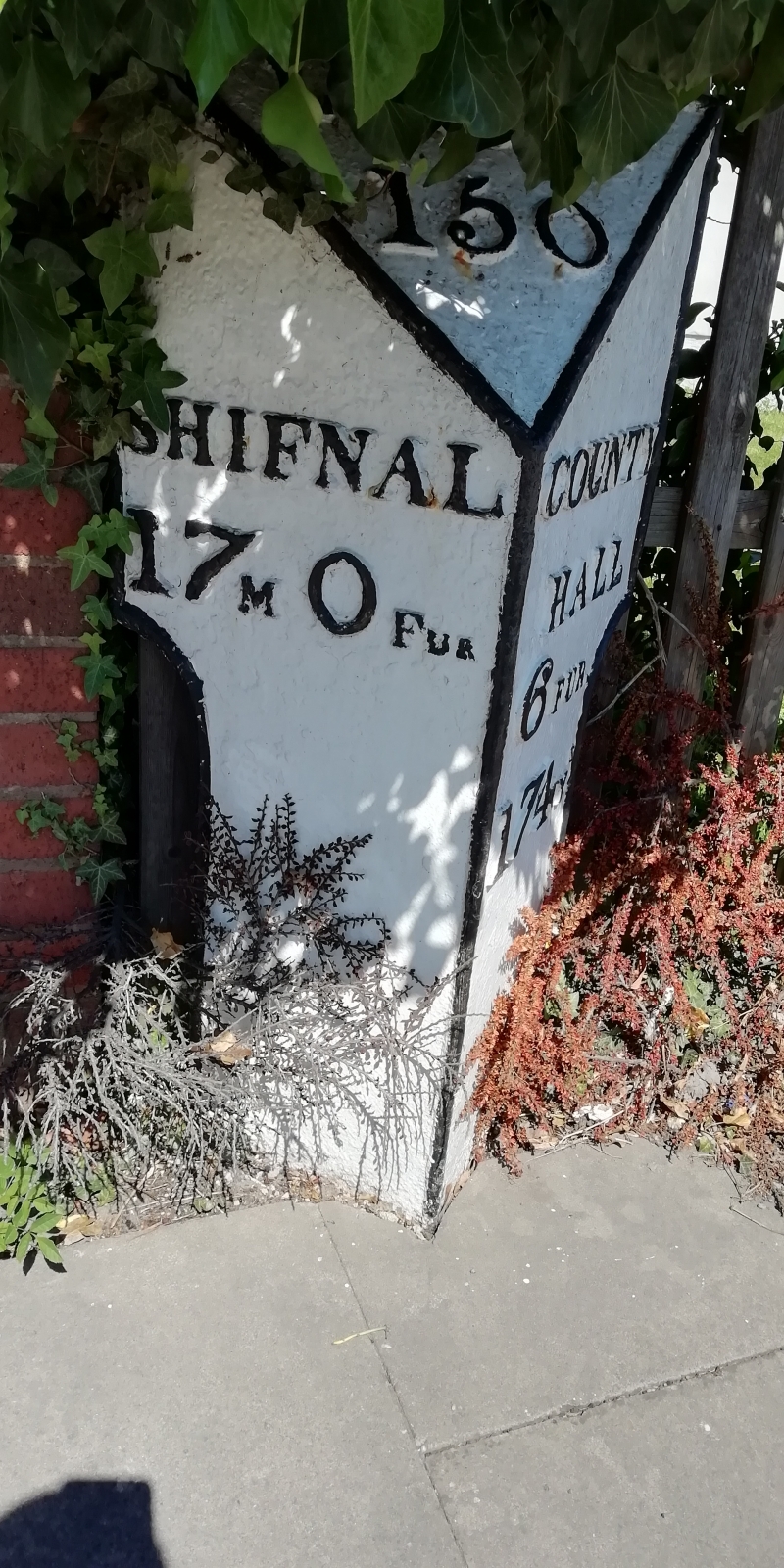
Mile post at junction with Bell Lane
II
Mile post. Early C19, but possibly not in situ. Triangular,
with raking top panel. Embossed lettering records the
following distances: LONDON 150, COUNTY HALL 6 FUR 174 YD,
SHIFNAL 17 M 0 FUR.
Listing NGR: SJ5043312226
External links are from the relevant listing authority and, where applicable, Wikidata. Wikidata IDs may be related buildings as well as this specific building. If you want to add or update a link, you will need to do so by editing the Wikidata entry.


Other nearby listed buildings
