Approximate Location Map
Large Map »
Latitude: 51.0294 / 51°1'45"N
Longitude: -0.5503 / 0°33'0"W
OS Eastings: 501760
OS Northings: 126557
OS Grid: TQ017265
Mapcode National: GBR FG2.KNV
Mapcode Global: FRA 96QD.KF7
Plus Code: 9C3X2CHX+QV
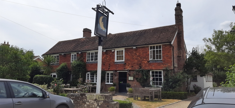
Entry Name: The Half Moon Inn
Listing Date: 22 May 1985
Grade: II
Source: Historic England
Source ID: 1273798
English Heritage Legacy ID: 417117
ID on this website: 101273798
Location: Kirdford, Chichester, West Sussex, RH14
County: West Sussex
District: Chichester
Civil Parish: Kirdford
Built-Up Area: Kirdford
Traditional County: Sussex
Lieutenancy Area (Ceremonial County): West Sussex
Church of England Parish: Kirdford
Church of England Diocese: Chichester
Tagged with: Inn
TQ 0126 KIRDFORD KIRDFORD VILLAGE
20/581 The Half Moon Inn
GV II
Public house. C18. Two storeys. Five windows. Ground floor red brick and grey
headers, above tile-hung. Tiled roof. Casement windows.
Listing NGR: TQ0175726556
External links are from the relevant listing authority and, where applicable, Wikidata. Wikidata IDs may be related buildings as well as this specific building. If you want to add or update a link, you will need to do so by editing the Wikidata entry.


Other nearby listed buildings
