Approximate Location Map
Large Map »
Latitude: 50.8442 / 50°50'39"N
Longitude: -0.6198 / 0°37'11"W
OS Eastings: 497266
OS Northings: 105868
OS Grid: SU972058
Mapcode National: GBR FJ4.S53
Mapcode Global: FRA 96LV.VQT
Plus Code: 9C2XR9VJ+M3
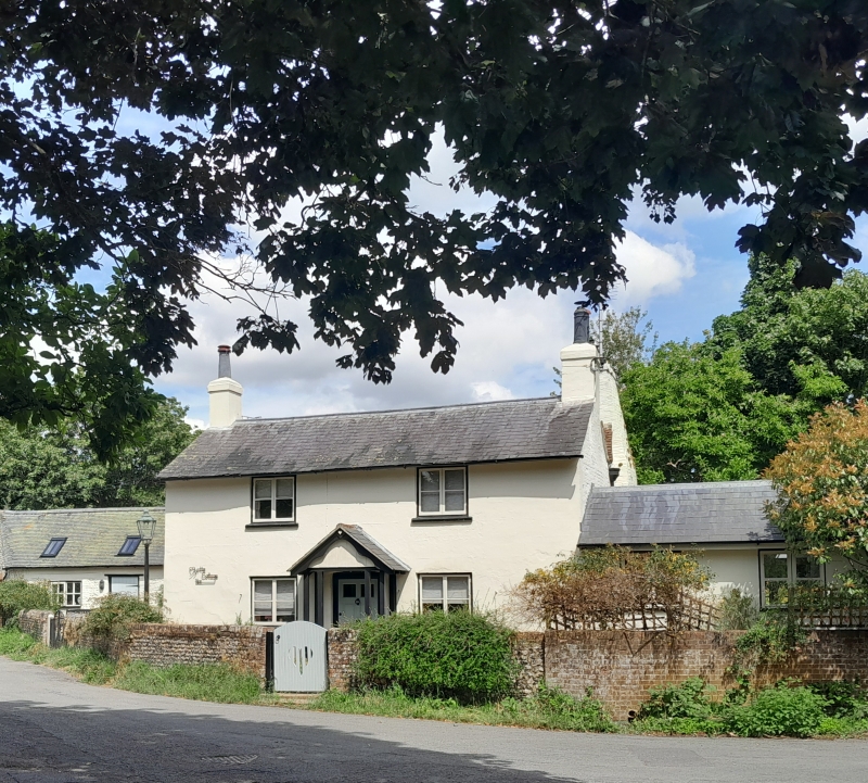
Entry Name: Myrtle Cottage
Listing Date: 20 September 1984
Grade: II
Source: Historic England
Source ID: 1274883
English Heritage Legacy ID: 414006
ID on this website: 101274883
Location: Walberton, Arun, West Sussex, BN18
County: West Sussex
District: Arun
Civil Parish: Walberton
Built-Up Area: Westergate
Traditional County: Sussex
Lieutenancy Area (Ceremonial County): West Sussex
Church of England Parish: Walberton
Church of England Diocese: Chichester
Tagged with: Cottage
SU 90NE WALBERTON THE STREET
8/398 (north side)
Myrtle Cottage
II
Early C19. Two storeys. Two windows. Stuccoed. Slate roof. Casement windows.
Doorway with pediment-shaped hood and door of six fielded panels.
Listing NGR: SU9726605864
External links are from the relevant listing authority and, where applicable, Wikidata. Wikidata IDs may be related buildings as well as this specific building. If you want to add or update a link, you will need to do so by editing the Wikidata entry.


Other nearby listed buildings
