Approximate Location Map
Large Map »
Latitude: 51.0432 / 51°2'35"N
Longitude: -0.8555 / 0°51'19"W
OS Eastings: 480329
OS Northings: 127715
OS Grid: SU803277
Mapcode National: GBR CBV.DK7
Mapcode Global: FRA 963C.6K5
Plus Code: 9C3X24VV+7Q
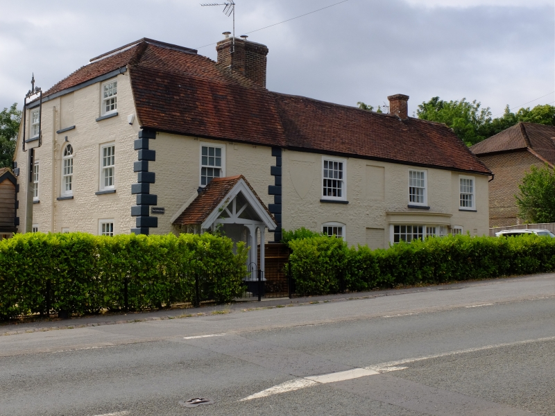
Entry Name: The Sun Inn
Listing Date: 26 November 1987
Grade: II
Source: Historic England
Source ID: 1275545
English Heritage Legacy ID: 411990
Also known as: Sun Inn
The Sun Inn, Liss
ID on this website: 101275545
Location: Rake, Chichester, West Sussex, GU33
County: West Sussex
District: Chichester
Civil Parish: Rogate
Built-Up Area: Liss
Traditional County: Sussex
Lieutenancy Area (Ceremonial County): West Sussex
Church of England Parish: Milland St Luke
Church of England Diocese: Chichester
SU 82 NW
5/26
ROGATE
RAKE
The Sun Inn
II
Public house. Early C19. Faced with stone rubble, now painted. The northern
most window-bay has stuccoed quoins. Tiled roof. Glazing bars intact. C19
gabled porch at north end. Curved shop window portion to south of this.
Listing NGR: SU8032927715
External links are from the relevant listing authority and, where applicable, Wikidata. Wikidata IDs may be related buildings as well as this specific building. If you want to add or update a link, you will need to do so by editing the Wikidata entry.


Other nearby listed buildings
