Approximate Location Map
Large Map »
Latitude: 50.9638 / 50°57'49"N
Longitude: 0.4809 / 0°28'51"E
OS Eastings: 574308
OS Northings: 121197
OS Grid: TQ743211
Mapcode National: GBR PVV.GDP
Mapcode Global: FRA C6WK.K58
Plus Code: 9F22XF7J+G9
Entry Name: John's Cross Farmhouse
Listing Date: 13 May 1987
Grade: II
Source: Historic England
Source ID: 1275865
English Heritage Legacy ID: 411027
ID on this website: 101275865
Location: John's Cross, Rother, East Sussex, TN32
County: East Sussex
District: Rother
Civil Parish: Mountfield
Traditional County: Sussex
Lieutenancy Area (Ceremonial County): East Sussex
Church of England Parish: Mountfield All Saints
Church of England Diocese: Chichester
Tagged with: Farmhouse
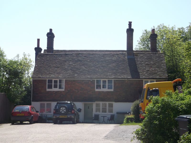
TQ 72 SW MOUNTFIELD JOHN'S CROSS ROAD
12/34 John's Cross Farmhouse
II
C18. Two parallel ranges. Two storeys. Three windows. Ground floor painted
brick, above tile-hung. Tiled roof. Casement windows. Doorway with flat hood
on brackets. Small bay on ground floor to west of this.
Listing NGR: TQ7430821197
External links are from the relevant listing authority and, where applicable, Wikidata. Wikidata IDs may be related buildings as well as this specific building. If you want to add or update a link, you will need to do so by editing the Wikidata entry.


Other nearby listed buildings
