Approximate Location Map
Large Map »
Latitude: 50.9611 / 50°57'39"N
Longitude: 0.4486 / 0°26'54"E
OS Eastings: 572049
OS Northings: 120818
OS Grid: TQ720208
Mapcode National: GBR PVT.L85
Mapcode Global: FRA C6TK.QLK
Plus Code: 9F22XC6X+CC
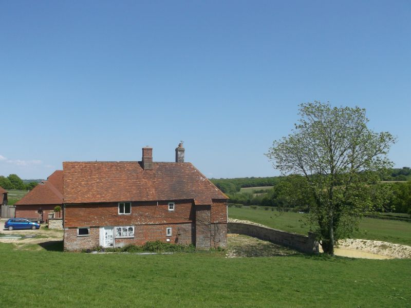
Entry Name: Baldwin's Farmhouse
Listing Date: 7 December 1977
Grade: II
Source: Historic England
Source ID: 1275867
English Heritage Legacy ID: 411033
ID on this website: 101275867
Location: Rother, East Sussex, TN32
County: East Sussex
District: Rother
Civil Parish: Mountfield
Traditional County: Sussex
Lieutenancy Area (Ceremonial County): East Sussex
Church of England Parish: Mountfield All Saints
Church of England Diocese: Chichester
Tagged with: Farmhouse
TQ 72 SW MOUNTFIELD KENT LANE
12/26 Baldwin's Farmhouse
7.12.77
II
L-shaped C16 timber-framed building, refronted with ashlar and red brick on
ground floor, above tile-hung. Steeply-pitched hipped tiled roof. Casement
windows. Brick chimney breast on north wall of east wing. Two storeys and attic
in gable ends. Two windows.
Listing NGR: TQ7204920818
External links are from the relevant listing authority and, where applicable, Wikidata. Wikidata IDs may be related buildings as well as this specific building. If you want to add or update a link, you will need to do so by editing the Wikidata entry.


Other nearby listed buildings
