Approximate Location Map
Large Map »
Latitude: 50.8391 / 50°50'20"N
Longitude: -0.6614 / 0°39'41"W
OS Eastings: 494348
OS Northings: 105248
OS Grid: SU943052
Mapcode National: GBR FJ8.7MB
Mapcode Global: FRA 96HW.B55
Plus Code: 9C2XR8QQ+JC
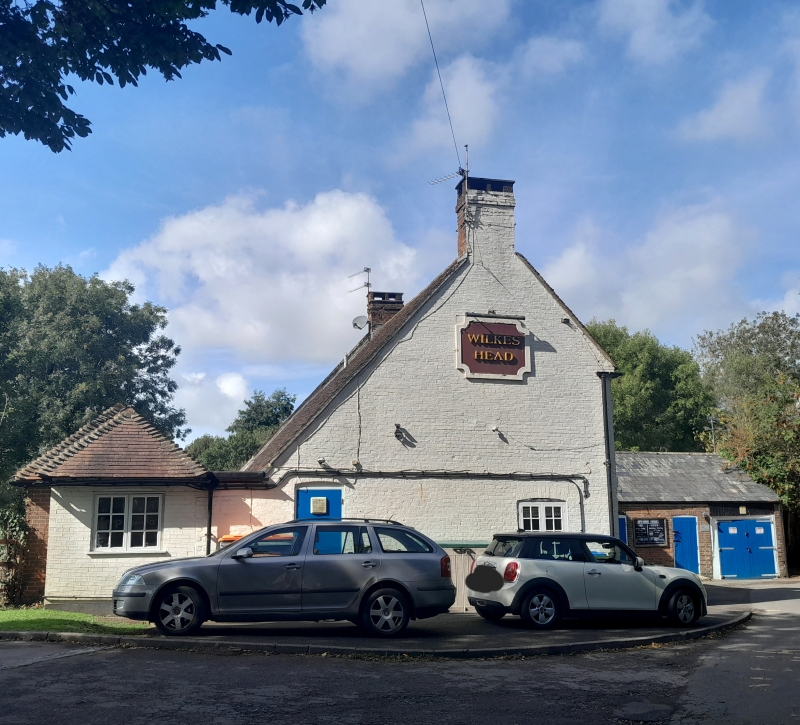
Entry Name: The Wilkes Head Inn
Listing Date: 20 September 1984
Grade: II
Source: Historic England
Source ID: 1276546
English Heritage Legacy ID: 297855
ID on this website: 101276546
Location: Westergate, Arun, West Sussex, PO20
County: West Sussex
District: Arun
Civil Parish: Eastergate
Built-Up Area: Westergate
Traditional County: Sussex
Lieutenancy Area (Ceremonial County): West Sussex
Church of England Parish: Aldingbourne, Barnham and Eastergate
Church of England Diocese: Chichester
Tagged with: Inn
SU 90 NW EASTERGATE CHURCH LANE
7/420
The Wilkes Head Inn
II
1763 circa. Two storeys and attic. Three windows. Two hipped dormers. Red brick.
Stringcourse. Tiled roof. Casement windows. Doorway with flat hood on brackets and
door of six fielded panels.
Listing NGR: SU9434805248
External links are from the relevant listing authority and, where applicable, Wikidata. Wikidata IDs may be related buildings as well as this specific building. If you want to add or update a link, you will need to do so by editing the Wikidata entry.


Other nearby listed buildings
