Approximate Location Map
Large Map »
Latitude: 50.9657 / 50°57'56"N
Longitude: -0.2174 / 0°13'2"W
OS Eastings: 525269
OS Northings: 119991
OS Grid: TQ252199
Mapcode National: GBR JM8.CV8
Mapcode Global: FRA B6FK.H3B
Plus Code: 9C2XXQ8M+72
Entry Name: The Parish Church of St Peter
Listing Date: 28 October 1957
Grade: I
Source: Historic England
Source ID: 1284819
English Heritage Legacy ID: 302794
ID on this website: 101284819
Location: St Peter's Church, Twineham, Mid Sussex, RH17
County: West Sussex
District: Mid Sussex
Civil Parish: Twineham
Traditional County: Sussex
Lieutenancy Area (Ceremonial County): West Sussex
Church of England Parish: Albourne, Sayers Common and Twineham
Church of England Diocese: Chichester
Tagged with: Church building
TWINEHAM CHURCH LANE
1.
5405
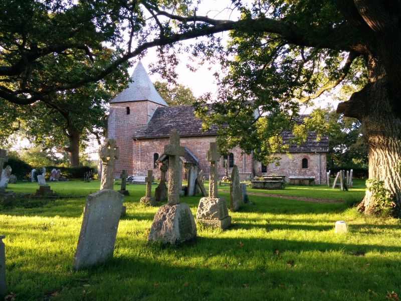
The Parish Church
of St Peter
TQ 21 NE 19/153 28/10/57
I
2.
Chancel, nave, south porch and west tower with broached shingled spire.
Early C16. Simple vernacular village church of red brick with Horsham slab
roof. Grade I for the rarity of small early C16 churches.
Listing NGR: TQ2526919993
External links are from the relevant listing authority and, where applicable, Wikidata. Wikidata IDs may be related buildings as well as this specific building. If you want to add or update a link, you will need to do so by editing the Wikidata entry.


Other nearby listed buildings
