Approximate Location Map
Large Map »
Latitude: 54.4014 / 54°24'5"N
Longitude: -1.7414 / 1°44'28"W
OS Eastings: 416887
OS Northings: 500695
OS Grid: NZ168006
Mapcode National: GBR JK8J.SZ
Mapcode Global: WHC6D.7M1M
Plus Code: 9C6WC725+HF
Entry Name: 24, the Green
Listing Date: 15 October 1973
Grade: II
Source: Historic England
Source ID: 1289677
English Heritage Legacy ID: 323021
ID on this website: 101289677
Location: Richmond, North Yorkshire, DL10
County: North Yorkshire
District: Richmondshire
Civil Parish: Richmond
Built-Up Area: Richmond
Traditional County: Yorkshire
Lieutenancy Area (Ceremonial County): North Yorkshire
Church of England Parish: Richmond with Holy Trinity with Hudswell
Church of England Diocese: Leeds
Tagged with: Building
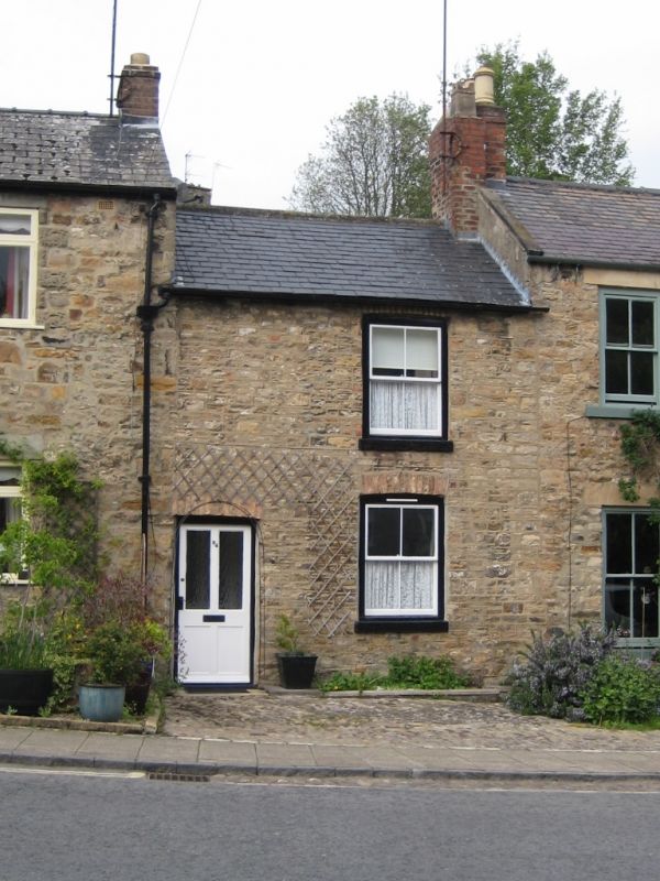
1. THE GREEN
1549 (North Side)
No 24
NZ 1600 NE 5/115
II GV
2.
Probably early C19, Two storeys, roughcast. Welsh slate roof. One window.
Brick arch to ground floor window, as to door of two panels. One brick
stack.
Nos 2 to 14 (even) and Nos 18 to 26 (even) form a group
Listing NGR: NZ1688700695
External links are from the relevant listing authority and, where applicable, Wikidata. Wikidata IDs may be related buildings as well as this specific building. If you want to add or update a link, you will need to do so by editing the Wikidata entry.


Other nearby listed buildings
