Approximate Location Map
Large Map »
Latitude: 51.5514 / 51°33'5"N
Longitude: -2.4659 / 2°27'57"W
OS Eastings: 367790
OS Northings: 183720
OS Grid: ST677837
Mapcode National: GBR JX.FDFP
Mapcode Global: VH88B.68QH
Plus Code: 9C3VHG2M+HJ
Entry Name: Holmray
Listing Date: 17 September 1952
Grade: II
Source: Historic England
Source ID: 1291239
English Heritage Legacy ID: 350707
ID on this website: 101291239
Location: Iron Acton, South Gloucestershire, BS37
County: South Gloucestershire
Civil Parish: Iron Acton
Built-Up Area: Iron Acton
Traditional County: Gloucestershire
Lieutenancy Area (Ceremonial County): Gloucestershire
Church of England Parish: Iron Acton
Church of England Diocese: Bristol
Tagged with: Building
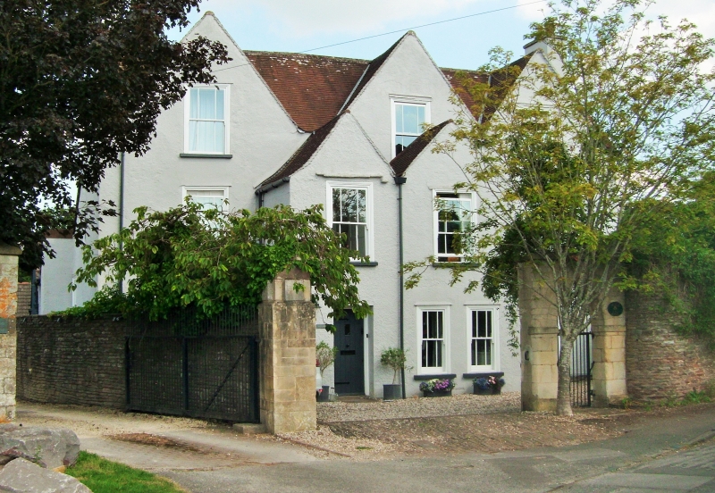
ST 68 SE IRON ACTON PARK STREET
2/23 Holmray
17.9.52 II
House. C17. Rendered, plain clay tiles. 2½ storey, 3 windows, in 3 gables
on main block, 2 windows in 2 projecting, 2 storey gables, all windows are
margin glazed sashes, one on projecting gable has remains of dripmould, C20
glazed doors below, large 2 storey rear wing.
Listing NGR: ST6779083720
External links are from the relevant listing authority and, where applicable, Wikidata. Wikidata IDs may be related buildings as well as this specific building. If you want to add or update a link, you will need to do so by editing the Wikidata entry.


Other nearby listed buildings
