Approximate Location Map
Large Map »
Latitude: 51.293 / 51°17'34"N
Longitude: 0.4076 / 0°24'27"E
OS Eastings: 567962
OS Northings: 157623
OS Grid: TQ679576
Mapcode National: GBR NPC.V5Q
Mapcode Global: VHJM5.0RTP
Plus Code: 9F327CV5+52
Entry Name: Railings to Old Vicarage
Listing Date: 30 November 1993
Grade: II
Source: Historic England
Source ID: 1292017
English Heritage Legacy ID: 392378
ID on this website: 101292017
Location: West Malling, Tonbridge and Malling, Kent, ME19
County: Kent
District: Tonbridge and Malling
Civil Parish: West Malling
Built-Up Area: West Malling
Traditional County: Kent
Lieutenancy Area (Ceremonial County): Kent
Church of England Parish: West Malling St Mary
Church of England Diocese: Rochester
Tagged with: Guard rail
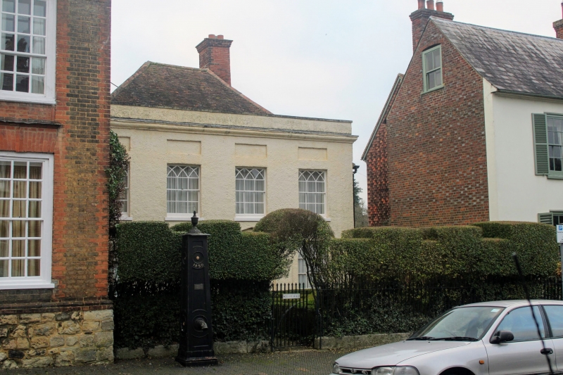
WEST MALLING
TQ6757 HIGH STREET
1156-0/2/62 Railings to Old Vicarage
GV II
Railings. Early C19. Stone base with cast-iron spear railings
with obelisk finials and 2 pedestrian entrances.
Listing NGR: TQ6796257621
External links are from the relevant listing authority and, where applicable, Wikidata. Wikidata IDs may be related buildings as well as this specific building. If you want to add or update a link, you will need to do so by editing the Wikidata entry.


Other nearby listed buildings
