Approximate Location Map
Large Map »
Latitude: 53.3933 / 53°23'35"N
Longitude: -3.0463 / 3°2'46"W
OS Eastings: 330516
OS Northings: 389006
OS Grid: SJ305890
Mapcode National: GBR 7Y56.89
Mapcode Global: WH876.5ZM0
Plus Code: 9C5R9XV3+8F
Entry Name: Number 57 with Gatepiers to Front Garden
Listing Date: 28 March 1974
Grade: II
Source: Historic England
Source ID: 1292321
English Heritage Legacy ID: 389112
ID on this website: 101292321
Location: Claughton, Wirral, Merseyside, CH43
County: Wirral
Electoral Ward/Division: Claughton
Parish: Non Civil Parish
Built-Up Area: Birkenhead
Traditional County: Cheshire
Lieutenancy Area (Ceremonial County): Merseyside
Church of England Parish: Birkenhead Christ the King
Church of England Diocese: Chester
SJ3089
789-1/7/15
BIRKENHEAD
ASHVILLE ROAD (South East side)
No.57 with gatepiers to front garden
28/03/74
GV
II
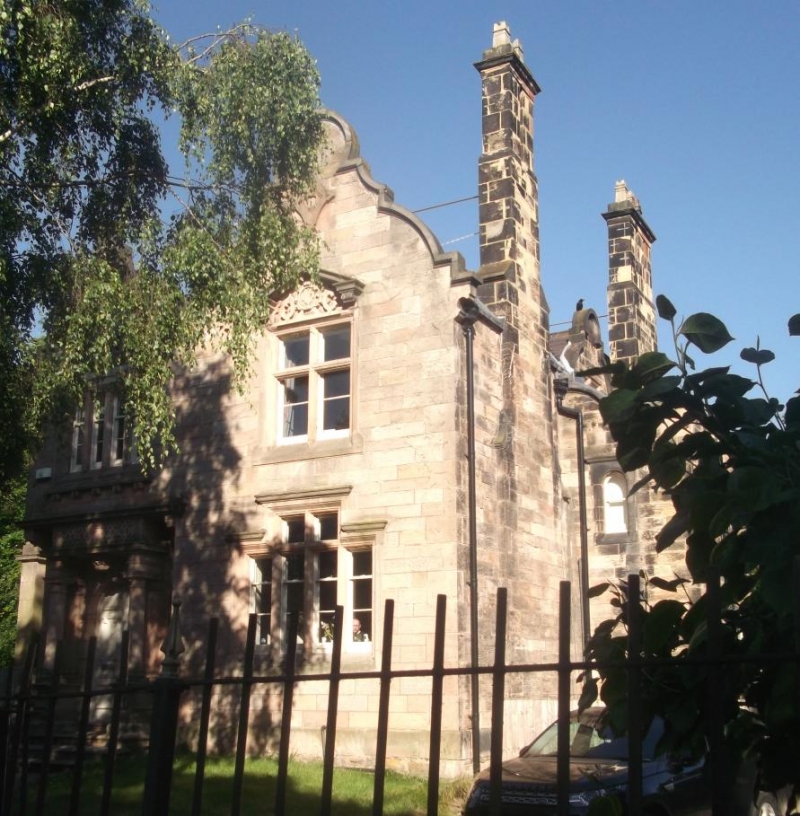
House. Dated 1854. Possibly by Walter Scott. Ashlar-faced with Welsh slate roof. Picturesque asymmetrical Jacobean style with rich detailing. Central entrance hall with principal rooms each side. Recessed porch with Mannerist Ionic shafts and brackets carrying entablature enriched with strapwork decoration each side of segmental archway. Right-hand bay advanced beneath Dutch gable, with stepped mullioned window to ground floor, and mullioned window above with broken pediment over. Lower Dutch gable over entrance. Left-hand bay faces side garden, with square bay window with elaborately carved mullions, panels in the entablature, and castellated parapet with ball finials. Dutch gable to rear elevation with date 1854 and initials W.H. in cartouche over squared bay window. End wall stacks. Panelled gate piers with shallow pyramidal copings. The house forms part of the original development of Birkenhead Park laid out by Joseph Paxton between 1844 and 1847.
(The Buildings of England: Pevsner N and Hubbard E: Cheshire: Harmondsworth: 1971-).
Listing NGR: SJ3051689006
External links are from the relevant listing authority and, where applicable, Wikidata. Wikidata IDs may be related buildings as well as this specific building. If you want to add or update a link, you will need to do so by editing the Wikidata entry.


Other nearby listed buildings
