Approximate Location Map
Large Map »
Latitude: 54.4009 / 54°24'3"N
Longitude: -1.3144 / 1°18'51"W
OS Eastings: 444606
OS Northings: 500819
OS Grid: NZ446008
Mapcode National: GBR MK8K.75
Mapcode Global: WHD7Q.SN92
Plus Code: 9C6WCM2P+96
Entry Name: Water Tower to South West of Gabriel Farmhouse
Listing Date: 30 October 1990
Grade: II
Source: Historic England
Source ID: 1294509
English Heritage Legacy ID: 333122
ID on this website: 101294509
Location: Ingleby Arncliffe, North Yorkshire, DL6
County: North Yorkshire
District: Hambleton
Civil Parish: Ingleby Arncliffe
Traditional County: Yorkshire
Lieutenancy Area (Ceremonial County): North Yorkshire
Church of England Parish: Ingleby Arncliffe All Saints
Church of England Diocese: York
Tagged with: Water tower
NZ 40 SW
8/63
INGLEBY ARNCLIFFE
INGLEBY ARNCLIFFE
East side
Water Tower to south-west of Gabriel Farmhouse
II
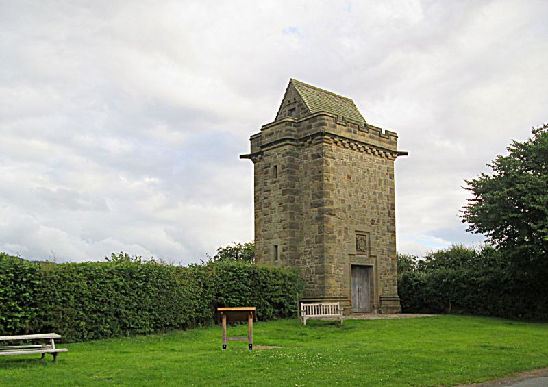
Water supply tower, 1915 dated on lintel for Sir Hugh Bell. Snecked
rockfaced sandstone, with large alternating quoins, on stepped and
hollow-chamfered plinth. Stone-flagged roof.
Square tower of 3-storey height, all in one stage. Central oak
boarded double door in hollow-chamfered and roll-moulded surround.
Inscription on lintel : Sir Hugh Bell built this tower as part of a
water supply to Arncliffe and Rounton AD 1915. Raised central panel
with achievement of arms and motto : Perseverantia. Double corbel
table and 4 gargoyles at eaves. Battlemented parapet with rounded
corners; saddleback roof. On right return a 2-light, hollow-chamfered
ground-floor window; and a similar window to rear. On left return a
stair projection with single lights in upper part.
Surrounding parterre of patterned coloured cobbles with inset:
H + F B 1915
Listing NGR: NZ4460600819
External links are from the relevant listing authority and, where applicable, Wikidata. Wikidata IDs may be related buildings as well as this specific building. If you want to add or update a link, you will need to do so by editing the Wikidata entry.


Other nearby listed buildings
