Approximate Location Map
Large Map »
Latitude: 52.4973 / 52°29'50"N
Longitude: -2.4602 / 2°27'36"W
OS Eastings: 368853
OS Northings: 288921
OS Grid: SO688889
Mapcode National: GBR BX.HP25
Mapcode Global: VH83P.9HRF
Plus Code: 9C4VFGWQ+WW
Entry Name: South Eudon
Listing Date: 9 March 1970
Grade: II
Source: Historic England
Source ID: 1294904
English Heritage Legacy ID: 254618
ID on this website: 101294904
Location: Shropshire, WV16
County: Shropshire
Civil Parish: Chetton
Traditional County: Shropshire
Lieutenancy Area (Ceremonial County): Shropshire
Church of England Parish: Chetton
Church of England Diocese: Hereford
Tagged with: Architectural structure
1.
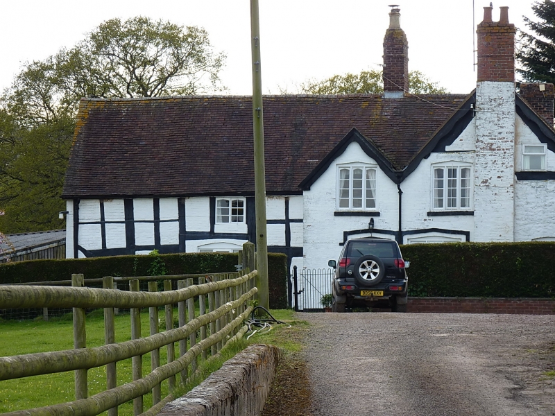
1954 CHETTON EUDON GEORGE
South Eudon
SO 68 NE 27/9 9.3.70.
II
2.
C17 timber framed farmhouse. L-shaped on plan. Limewashed brick nogging.
Listing NGR: SO6877488928
External links are from the relevant listing authority and, where applicable, Wikidata. Wikidata IDs may be related buildings as well as this specific building. If you want to add or update a link, you will need to do so by editing the Wikidata entry.


Other nearby listed buildings
