Approximate Location Map
Large Map »
Latitude: 54.2392 / 54°14'21"N
Longitude: -0.8769 / 0°52'36"W
OS Eastings: 473292
OS Northings: 483195
OS Grid: SE732831
Mapcode National: GBR QM9F.Y3
Mapcode Global: WHF9V.HQM0
Plus Code: 9C6X64QF+M6
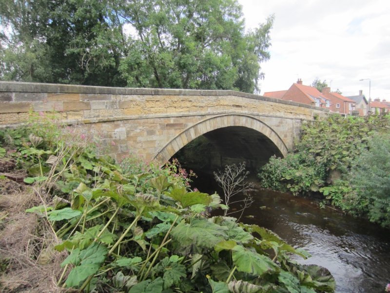
Entry Name: Marton Bridge
Listing Date: 6 October 1987
Grade: II
Source: Historic England
Source ID: 1296611
English Heritage Legacy ID: 329285
ID on this website: 101296611
Location: Marton, North Yorkshire, YO62
County: North Yorkshire
District: Ryedale
Civil Parish: Marton
Traditional County: Yorkshire
Lieutenancy Area (Ceremonial County): North Yorkshire
Tagged with: Bridge
NORTH YORKSHIRE
RYEDALE
5340
MARTON
SE 78 SW
2/22 Marton Bridge
- II
Bridge. Mid C18, widened later. Hammer-dressed sandstone. Single span.
Semicircular arch, roll-moulded on downstream side, between battered
abutments. Chamfered band beneath plain parapet, raked at centre.
Listing NGR: SE7329283195
External links are from the relevant listing authority and, where applicable, Wikidata. Wikidata IDs may be related buildings as well as this specific building. If you want to add or update a link, you will need to do so by editing the Wikidata entry.


Other nearby listed buildings
