Approximate Location Map
Large Map »
Latitude: 54.3095 / 54°18'34"N
Longitude: -1.8306 / 1°49'50"W
OS Eastings: 411121
OS Northings: 490449
OS Grid: SE111904
Mapcode National: GBR HLNL.HX
Mapcode Global: WHC6Q.VYH4
Plus Code: 9C6W8559+RQ
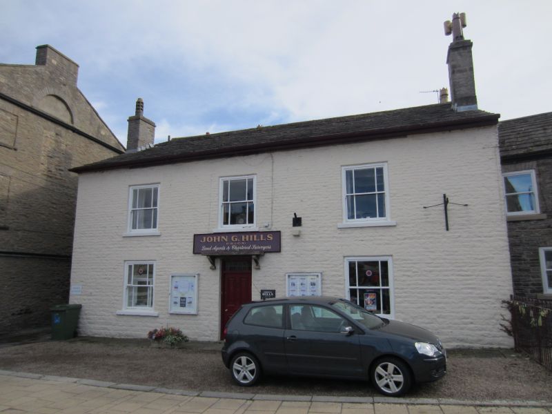
Entry Name: Lowood House
Listing Date: 28 October 1980
Grade: II
Source: Historic England
Source ID: 1302142
English Heritage Legacy ID: 321793
ID on this website: 101302142
Location: Leyburn, North Yorkshire, DL8
County: North Yorkshire
District: Richmondshire
Civil Parish: Leyburn
Built-Up Area: Leyburn
Traditional County: Yorkshire
Lieutenancy Area (Ceremonial County): North Yorkshire
Tagged with: House
SE 19 SW LEYBURN MARKET PLACE
(south side)
12/44 Lowood House
28/10/80
GV II
House, now offices. Early C19. Painted coursed rubble, stone slate roof.
2 storeys, 3 bays. Central 4-panel door below overlight with projecting slab
canopy above. Sash windows with margin lights. End stacks.
Listing NGR: SE1112190449
External links are from the relevant listing authority and, where applicable, Wikidata. Wikidata IDs may be related buildings as well as this specific building. If you want to add or update a link, you will need to do so by editing the Wikidata entry.


Other nearby listed buildings
