Approximate Location Map
Large Map »
Latitude: 55.6693 / 55°40'9"N
Longitude: -1.8014 / 1°48'5"W
OS Eastings: 412588
OS Northings: 641774
OS Grid: NU125417
Mapcode National: GBR H2VW.SJ
Mapcode Global: WHC05.9RFP
Plus Code: 9C7WM59X+PC
Entry Name: Cross Base C 5 Yards East of Church of St Mary
Listing Date: 15 May 1986
Grade: II
Source: Historic England
Source ID: 1303346
English Heritage Legacy ID: 237729
ID on this website: 101303346
Location: St Mary's Church, Holy Island, Northumberland, TD15
County: Northumberland
Civil Parish: Holy Island
Traditional County: Northumberland
Lieutenancy Area (Ceremonial County): Northumberland
Church of England Parish: Holy Island St Mary the Virgin
Church of England Diocese: Newcastle
Tagged with: Monumental cross
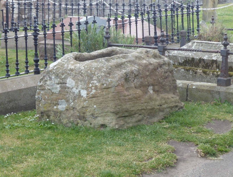
NU 1241 HOLY ISLAND
12/20 Cross base c.5 yards
east of Church of
St. Mary
GV II
Cross base. Medieval. Stone rectangular block c.4 ft by 3 ft at base,
tapering to c.3 ft by 2 ft at top, with rectangular socket for shaft.
Listing NGR: NU1258841774
External links are from the relevant listing authority and, where applicable, Wikidata. Wikidata IDs may be related buildings as well as this specific building. If you want to add or update a link, you will need to do so by editing the Wikidata entry.


Other nearby listed buildings
