Approximate Location Map
Large Map »
Latitude: 50.7927 / 50°47'33"N
Longitude: -3.1832 / 3°10'59"W
OS Eastings: 316699
OS Northings: 99905
OS Grid: SY166999
Mapcode National: GBR LX.ZCD1
Mapcode Global: FRA 466Z.ZNG
Plus Code: 9C2RQRV8+3P
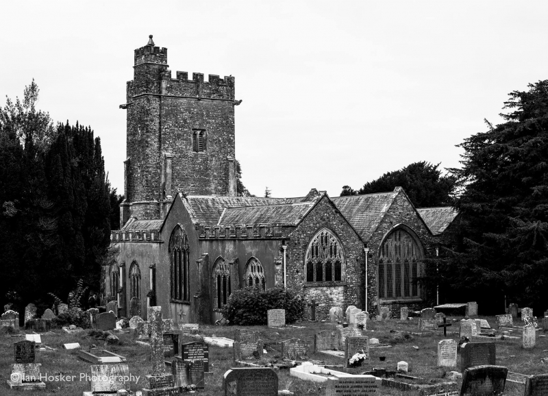
Entry Name: Church of St Michael
Listing Date: 1 June 1949
Grade: II*
Source: Historic England
Source ID: 1306112
English Heritage Legacy ID: 84923
ID on this website: 101306112
Location: St Michael and All Angels Church, Honiton, East Devon, EX14
County: Devon
District: East Devon
Civil Parish: Honiton
Built-Up Area: Honiton
Traditional County: Devon
Lieutenancy Area (Ceremonial County): Devon
Church of England Parish: Honiton with Monkton
Church of England Diocese: Exeter
Tagged with: Church building
597/5/2 CHURCH OF ST MICHAEL
01-JUN-49
II*
Now Chapel-of-Ease. Dates mainly from late C15. Interior destroyed by fire
and rebuilt 1912.
Listing NGR: SY1669999905
External links are from the relevant listing authority and, where applicable, Wikidata. Wikidata IDs may be related buildings as well as this specific building. If you want to add or update a link, you will need to do so by editing the Wikidata entry.


Other nearby listed buildings
