Approximate Location Map
Large Map »
Latitude: 53.6244 / 53°37'27"N
Longitude: -1.7187 / 1°43'7"W
OS Eastings: 418704
OS Northings: 414246
OS Grid: SE187142
Mapcode National: GBR JVFJ.QG
Mapcode Global: WHCB8.K5S8
Plus Code: 9C5WJ7FJ+QG
Entry Name: Boundary Stone Opposite Entrance to Rowley Mills
Listing Date: 16 May 1984
Grade: II
Source: Historic England
Source ID: 1313346
English Heritage Legacy ID: 341205
ID on this website: 101313346
Location: Dogley Lane, Kirklees, West Yorkshire, HD8
County: Kirklees
Civil Parish: Kirkburton
Built-Up Area: Huddersfield
Traditional County: Yorkshire
Lieutenancy Area (Ceremonial County): West Yorkshire
Church of England Parish: Lepton St John
Church of England Diocese: Leeds
Tagged with: Boundary marker
SE 11 SE PENISTONE ROAD
SE 1870 1424 (west side)
Woodsome Bridge
5/90
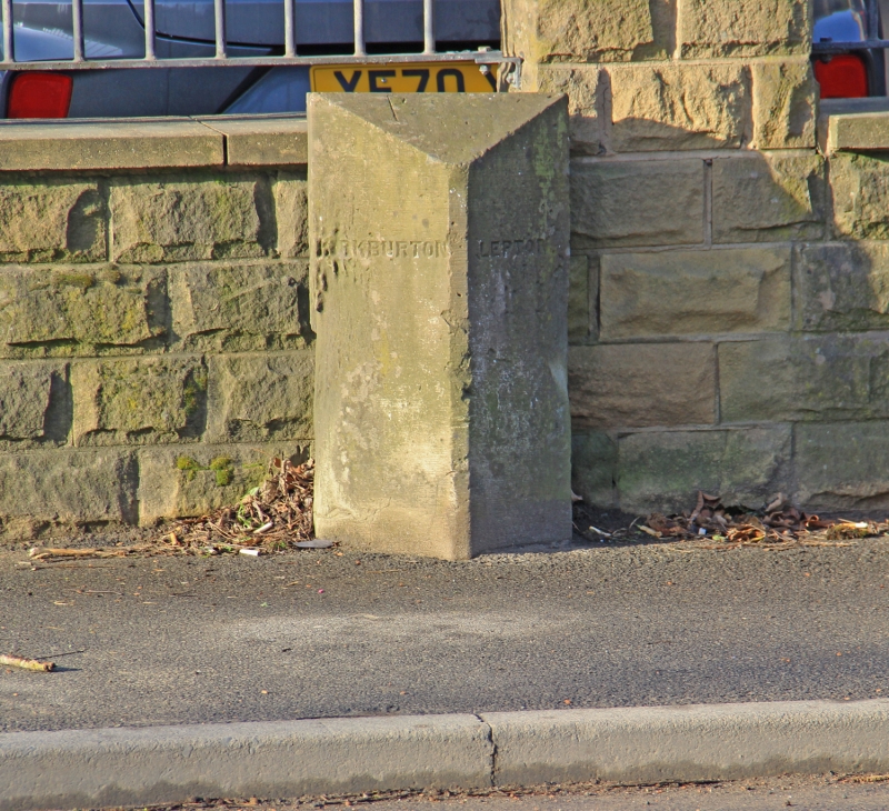
Boundary stone opposite
entrance to Rowley Mills
II
Triangular stone boundary post. Mid to late C19. Inscribed in
capitals on 2 sides. KIRKBURTON LEPTON.
Listing NGR: SE1870414246
External links are from the relevant listing authority and, where applicable, Wikidata. Wikidata IDs may be related buildings as well as this specific building. If you want to add or update a link, you will need to do so by editing the Wikidata entry.


Other nearby listed buildings
