Approximate Location Map
Large Map »
Latitude: 53.5575 / 53°33'26"N
Longitude: -1.8192 / 1°49'9"W
OS Eastings: 412073
OS Northings: 406777
OS Grid: SE120067
Mapcode National: GBR HWQ9.YG
Mapcode Global: WHCBF.0VZ4
Plus Code: 9C5WH54J+X8
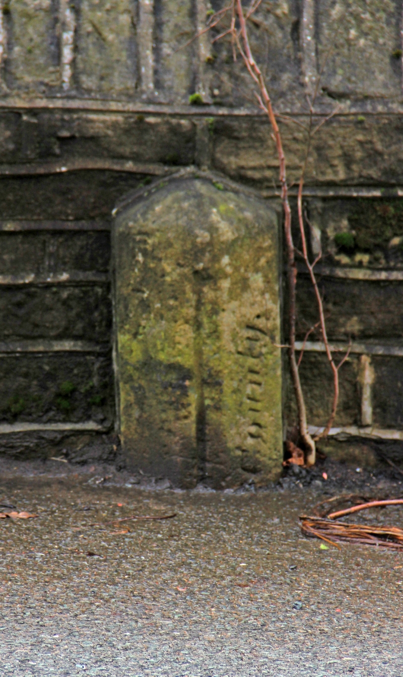
Entry Name: Boundary Stone Opposite Post Office
Listing Date: 4 August 1983
Grade: II
Source: Historic England
Source ID: 1313623
English Heritage Legacy ID: 340641
ID on this website: 101313623
Location: Holmbridge, Kirklees, West Yorkshire, HD9
County: Kirklees
Civil Parish: Holme Valley
Built-Up Area: Holmfirth
Traditional County: Yorkshire
Lieutenancy Area (Ceremonial County): West Yorkshire
Church of England Parish: Holmbridge St David
Church of England Diocese: Leeds
Tagged with: Boundary marker
SE 10 NW WOODHEAD ROAD
4/413 (Holmbridge)
Boundary Stone Opposite
Post Office
II
Boundary stone. Late C19. Shaped stone post with inscription: County.
Listing NGR: SE1207306776
External links are from the relevant listing authority and, where applicable, Wikidata. Wikidata IDs may be related buildings as well as this specific building. If you want to add or update a link, you will need to do so by editing the Wikidata entry.


Other nearby listed buildings
