Approximate Location Map
Large Map »
Latitude: 53.9113 / 53°54'40"N
Longitude: -1.7415 / 1°44'29"W
OS Eastings: 417076
OS Northings: 446157
OS Grid: SE170461
Mapcode National: GBR JR86.RN
Mapcode Global: WHC8Q.6YYD
Plus Code: 9C5WW765+G9
Entry Name: Burley Lodge
Listing Date: 18 July 1949
Last Amended: 20 May 1976
Grade: II
Source: Historic England
Source ID: 1314246
English Heritage Legacy ID: 337651
ID on this website: 101314246
Location: Burley in Wharfedale, Bradford, West Yorkshire, LS29
County: Bradford
Civil Parish: Burley
Built-Up Area: Burley in Wharfedale
Traditional County: Yorkshire
Lieutenancy Area (Ceremonial County): West Yorkshire
Church of England Parish: Burley-in-Wharfedale St Mary the Blessed Virgin
Church of England Diocese: Leeds
Tagged with: Gatehouse
This list entry was subject to a Minor Amendment on 2 June 2023 to update the group value statement and to reformat the text to current standards
SE 1746 8/22
Burley in Wharfedale LS29 7DT
MAIN STREET (North Side)
Burley Lodge
(Formerly listed as No 1 (Burley Lodge) MAIN STREET, previously listed as The Lodge, Otley Road, Burley in Wharfedale)
18.7.49.
GV
II
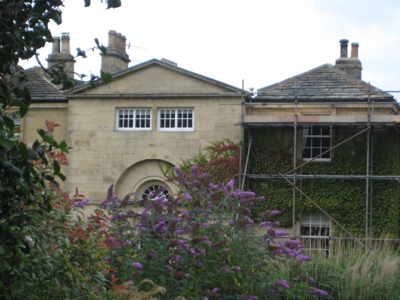
C18. Two storeys. Ashlar. Central portion containing principal doorway slightly projecting with two windows and gable above doorway, which has columns supporting lintel with triglyphs, surmounted by semi-circular arch with cast lead fanlight. Wing at each side of central block with one window to each floor, with projecting heads and sills and moulded architraves. Eastern side has three windows similar to front and a semi-circular bay window. Ground floor room on this side has decorated plaster ceiling and frieze of Adam type; also fireplace. West side has C19 Gothic wing (now part of Chevin House).
Burley Lodge, No 2 (Highway Cottage) and Chevin House, Nos 4 to 16 (even), Nos 24 to 30 (even) and 30A, 2 Post Office Yard, St Mary's Church, wall around ground south of mill pond (along Main Street and west side of Corn Mill Lane), and the Malt Shovel Hotel, form a group.
Listing NGR: SE1707646157
External links are from the relevant listing authority and, where applicable, Wikidata. Wikidata IDs may be related buildings as well as this specific building. If you want to add or update a link, you will need to do so by editing the Wikidata entry.


Other nearby listed buildings
