Approximate Location Map
Large Map »
Latitude: 54.4844 / 54°29'3"N
Longitude: -0.6191 / 0°37'8"W
OS Eastings: 489559
OS Northings: 510770
OS Grid: NZ895107
Mapcode National: GBR SJ3L.R7
Mapcode Global: WHG9Y.GKD1
Plus Code: 9C6XF9MJ+Q9
Entry Name: Manor House
Listing Date: 4 December 1972
Grade: II
Source: Historic England
Source ID: 1316351
English Heritage Legacy ID: 326524
ID on this website: 101316351
Location: Whitby, North Yorkshire, YO21
County: North Yorkshire
District: Scarborough
Civil Parish: Whitby
Built-Up Area: Whitby
Traditional County: Yorkshire
Lieutenancy Area (Ceremonial County): North Yorkshire
Church of England Parish: Whitby St Mary
Church of England Diocese: York
Tagged with: House
1.
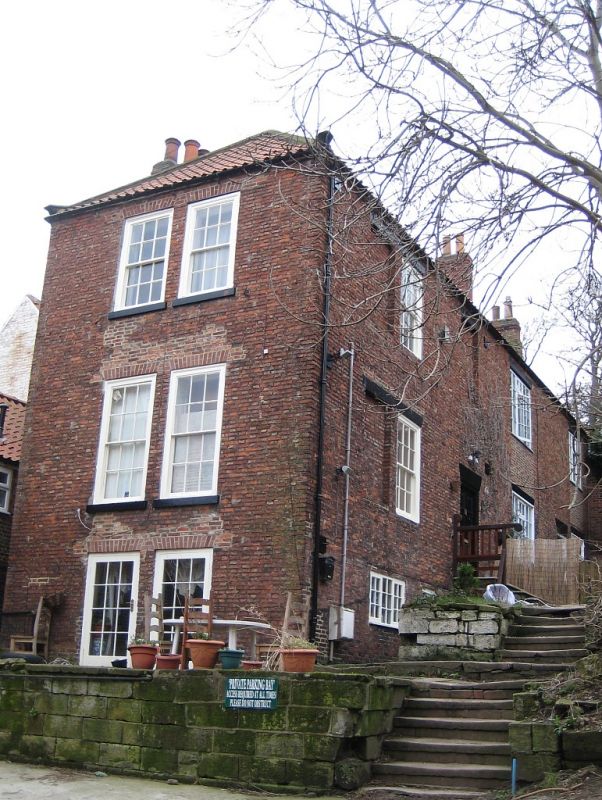
1811 BAGDALE
(South Side)
Manor House
NZ 8910 3/24
II
2.
Late Cl8. 3 storeys to road, brick. Pantile roof, hipped to road. 2 sashes
to road, stone arches, glazing bars, those to 1st and 2nd floors with jalousies.
Long range running back from road with various windows.
Listing NGR: NZ8955910770
External links are from the relevant listing authority and, where applicable, Wikidata. Wikidata IDs may be related buildings as well as this specific building. If you want to add or update a link, you will need to do so by editing the Wikidata entry.


Other nearby listed buildings
