Approximate Location Map
Large Map »
Latitude: 53.783 / 53°46'58"N
Longitude: -1.0748 / 1°4'29"W
OS Eastings: 461058
OS Northings: 432244
OS Grid: SE610322
Mapcode National: GBR NSYP.3N
Mapcode Global: WHFD2.G5DR
Plus Code: 9C5WQWMG+53
Entry Name: 98A Gowthorpe
Listing Date: 14 November 1980
Last Amended: 23 September 1981
Grade: II
Source: Historic England
Source ID: 1316643
English Heritage Legacy ID: 325769
ID on this website: 101316643
Location: Westfield, North Yorkshire, YO8
County: North Yorkshire
District: Selby
Civil Parish: Selby
Built-Up Area: Selby
Traditional County: Yorkshire
Lieutenancy Area (Ceremonial County): North Yorkshire
Church of England Parish: Selby St James
Church of England Diocese: York
Tagged with: Building
This list entry was subject to a Minor Amendment on 8 September 2021 to remove superfluous amendment details and to reformat the text to current standards
SE 6132 SW
4/81
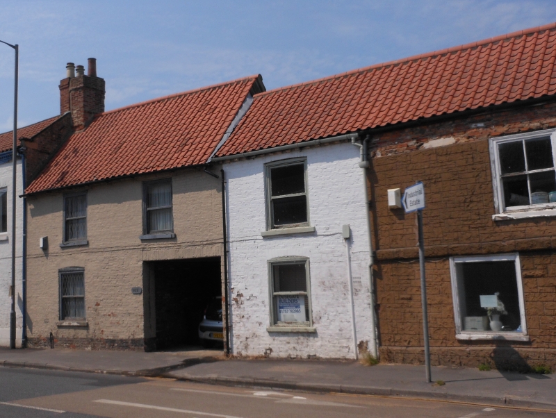
GOWTHORPE (north side)
No 98A
(Formerly listed as No 100)
GV
II
Probably early C19. Brown brick. Pitched pantile roof. Two storeys. One bay: sashes. Boarded door to passageway.
Listing NGR: SE6105832244
External links are from the relevant listing authority and, where applicable, Wikidata. Wikidata IDs may be related buildings as well as this specific building. If you want to add or update a link, you will need to do so by editing the Wikidata entry.


Other nearby listed buildings
