Approximate Location Map
Large Map »
Latitude: 54.4006 / 54°24'2"N
Longitude: -1.7403 / 1°44'25"W
OS Eastings: 416956
OS Northings: 500605
OS Grid: NZ169006
Mapcode National: GBR JK9K.08
Mapcode Global: WHC6D.7NJ8
Plus Code: 9C6WC725+7V
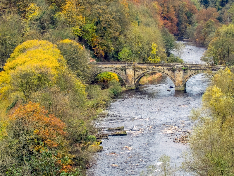
Entry Name: The Green Bridge
Listing Date: 1 August 1952
Grade: II*
Source: Historic England
Source ID: 1318388
English Heritage Legacy ID: 322892
ID on this website: 101318388
Location: Richmond, North Yorkshire, DL10
County: North Yorkshire
District: Richmondshire
Civil Parish: Richmond
Built-Up Area: Richmond
Traditional County: Yorkshire
Lieutenancy Area (Ceremonial County): North Yorkshire
Church of England Parish: Richmond with Holy Trinity with Hudswell
Church of England Diocese: Leeds
1. BRIDGE STREET
1549 -------------
The Green Bridge
NZ 1600 NE 5/32 1.8.52.
II* GV
2.
Dated 1789. Bridge in ashlar, of three moulded stone arches with rounded
bays over each pier. Plain stone parapet and capping. Architect: Carr
of York.
The Green Bridge forms a group with listed buildings in Bridge Street
Listing NGR: NZ1695600605
External links are from the relevant listing authority and, where applicable, Wikidata. Wikidata IDs may be related buildings as well as this specific building. If you want to add or update a link, you will need to do so by editing the Wikidata entry.


Other nearby listed buildings
