Approximate Location Map
Large Map »
Latitude: 51.4057 / 51°24'20"N
Longitude: -1.131 / 1°7'51"W
OS Eastings: 460541
OS Northings: 167766
OS Grid: SU605677
Mapcode National: GBR 93C.WBJ
Mapcode Global: VHCZG.BXYS
Plus Code: 9C3WCV49+7J
Entry Name: Boundary Stone at Su 6057 6777
Listing Date: 10 November 1983
Grade: II
Source: Historic England
Source ID: 1319495
English Heritage Legacy ID: 39591
ID on this website: 101319495
Location: Lower Padworth, West Berkshire, RG7
County: West Berkshire
Civil Parish: Beenham
Built-Up Area: Aldermaston Wharf
Traditional County: Berkshire
Lieutenancy Area (Ceremonial County): Berkshire
Church of England Parish: Beenham Valence
Church of England Diocese: Oxford
Tagged with: Boundary marker
PADWORTH BATH ROAD (south-east
SU 66 NW side)
4/2 Boundary Stone At
SU 6057 6777
- II
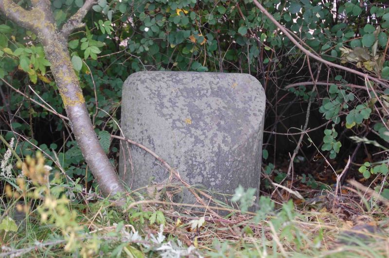
Boundary stone. 1828. Stone. Inscribed; top: Boundary 1828; east face:
Parish of Beenham; west face: Parish of Padworth to the middle of the road.
Listing NGR: SU6054167766
External links are from the relevant listing authority and, where applicable, Wikidata. Wikidata IDs may be related buildings as well as this specific building. If you want to add or update a link, you will need to do so by editing the Wikidata entry.


Other nearby listed buildings
