Approximate Location Map
Large Map »
Latitude: 54.5545 / 54°33'16"N
Longitude: -1.3371 / 1°20'13"W
OS Eastings: 442968
OS Northings: 517898
OS Grid: NZ429178
Mapcode National: GBR MH3S.93
Mapcode Global: WHD6Y.FSH9
Plus Code: 9C6WHM37+R4
Entry Name: 27 and 29, Hartburn Village
Listing Date: 21 June 1985
Grade: II
Source: Historic England
Source ID: 1325981
English Heritage Legacy ID: 59278
ID on this website: 101325981
Location: Oxbridge, Stockton-on-Tees, North Yorkshire, TS18
County: Stockton-on-Tees
Electoral Ward/Division: Hartburn
Parish: Non Civil Parish
Built-Up Area: Stockton-on-Tees
Traditional County: Durham
Lieutenancy Area (Ceremonial County): County Durham
Church of England Parish: Stockton-on-Tees St Peter
Church of England Diocese: Durham
Tagged with: Building
HZ 4217 NE EAST HARTBURN HARTBURN VILLAGE
(South side)
32/327
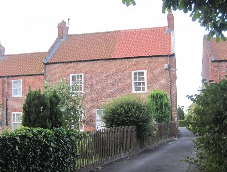
Nos 27 and 29
GV II
c18. 2 storeys and 1 window each. Ivy covered brick; brick flat arches to
glazing bar sash windows. Paired doorways. Pantile roof with raised verges and
2 brick chimneys; plastic gutter.
Listing NGR: NZ4296817898
External links are from the relevant listing authority and, where applicable, Wikidata. Wikidata IDs may be related buildings as well as this specific building. If you want to add or update a link, you will need to do so by editing the Wikidata entry.


Other nearby listed buildings
