Approximate Location Map
Large Map »
Latitude: 50.7224 / 50°43'20"N
Longitude: -3.5277 / 3°31'39"W
OS Eastings: 292260
OS Northings: 92534
OS Grid: SX922925
Mapcode National: GBR P1.90S5
Mapcode Global: FRA 37H5.HHX
Plus Code: 9C2RPFCC+XW
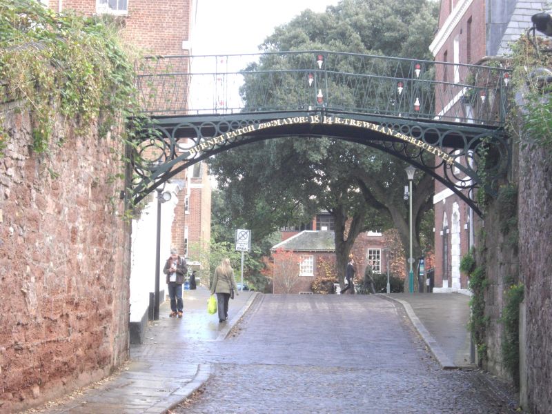
Entry Name: Iron Footbridge
Listing Date: 29 January 1953
Grade: II*
Source: Historic England
Source ID: 1333351
English Heritage Legacy ID: 88928
Also known as: Burnet Patch footbridge
ID on this website: 101333351
Location: Barnfield, Exeter, Devon, EX1
County: Devon
District: Exeter
Electoral Ward/Division: St David's
Parish: Non Civil Parish
Built-Up Area: Exeter
Traditional County: Devon
Lieutenancy Area (Ceremonial County): Devon
Church of England Parish: Exeter St Leonard
Church of England Diocese: Exeter
Tagged with: Footbridge
CATHEDRAL CLOSE
1.
1092
Iron Footbridge
SX 9292 NW 3/109 29.l.53.
II* GV
2.
Delicate cast-iron bridge over entrance to Close. Carries footpath running along
top of City Wall. Inscribed "1814 Burnet Patch, Mayor: R Trewman, Receiver."
All the listed buildings in Cathedral Close form a group.
Listing NGR: SX9221792557
External links are from the relevant listing authority and, where applicable, Wikidata. Wikidata IDs may be related buildings as well as this specific building. If you want to add or update a link, you will need to do so by editing the Wikidata entry.


Other nearby listed buildings
