Approximate Location Map
Large Map »
Latitude: 51.2821 / 51°16'55"N
Longitude: 1.0802 / 1°4'48"E
OS Eastings: 614905
OS Northings: 158168
OS Grid: TR149581
Mapcode National: GBR TY2.HYG
Mapcode Global: VHLGM.N1YG
Plus Code: 9F3373JJ+R3
Entry Name: 6, Mill Lane
Listing Date: 7 September 1973
Grade: II
Source: Historic England
Source ID: 1334332
English Heritage Legacy ID: 439783
ID on this website: 101334332
Location: Canterbury, Kent, CT1
County: Kent
District: Canterbury
Electoral Ward/Division: Westgate
Parish: Non Civil Parish
Built-Up Area: Canterbury
Traditional County: Kent
Lieutenancy Area (Ceremonial County): Kent
Tagged with: Building
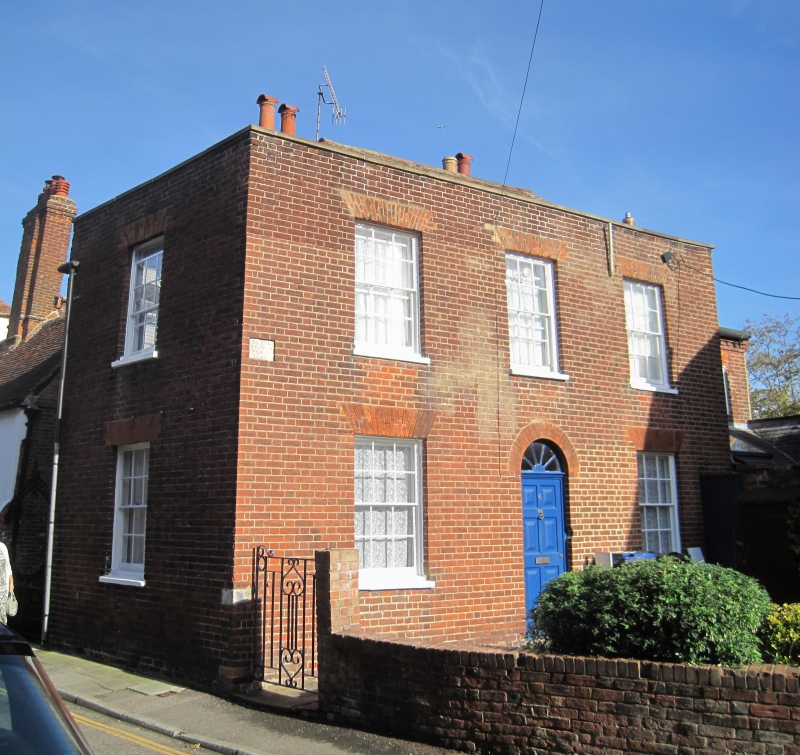
1.
944 MILL LANE
(East Side)
No 6
TR 1458 SE 2/567
II GV
2.
Mid C19. 2 storeys red brick. Hipped tiled roof. 3 sashes with most glazing
bars intact. Staple round-headed doorcase with modern door. Side elevation
has 1 blank.
Nos 2 to 12 (consec) form a group.
Listing NGR: TR1490658166
External links are from the relevant listing authority and, where applicable, Wikidata. Wikidata IDs may be related buildings as well as this specific building. If you want to add or update a link, you will need to do so by editing the Wikidata entry.


Other nearby listed buildings
