Approximate Location Map
Large Map »
Latitude: 53.368 / 53°22'4"N
Longitude: -1.8152 / 1°48'54"W
OS Eastings: 412390
OS Northings: 385700
OS Grid: SK123857
Mapcode National: GBR HYRH.SC
Mapcode Global: WHCCD.2LWV
Plus Code: 9C5W959M+6W
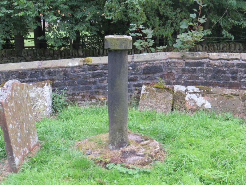
Entry Name: Sundial in Old Churchyard
Listing Date: 24 September 1984
Grade: II
Source: Historic England
Source ID: 1338500
English Heritage Legacy ID: 82518
ID on this website: 101338500
Location: Edale, High Peak, Derbyshire, S33
County: Derbyshire
District: High Peak
Civil Parish: Edale
Traditional County: Derbyshire
Lieutenancy Area (Ceremonial County): Derbyshire
Church of England Parish: Edale Holy and Undivided Trinity
Church of England Diocese: Derby
Tagged with: Sundial
SK 18 NW PARISH OF EDALE GRINDSBROOK MAIN STREET
(East Side)
3/58 Sundial in old Churchyard
II
GV
Sundial. Late C17. Gritstone. Square pillar with chamfered angles, standing on
a circular plinth. Large square top also with chamfered angles. Base plate on
top but the style is missing.
Listing NGR: SK1239085700
External links are from the relevant listing authority and, where applicable, Wikidata. Wikidata IDs may be related buildings as well as this specific building. If you want to add or update a link, you will need to do so by editing the Wikidata entry.


Other nearby listed buildings
