Approximate Location Map
Large Map »
Latitude: 52.6022 / 52°36'8"N
Longitude: 0.378 / 0°22'40"E
OS Eastings: 561142
OS Northings: 303148
OS Grid: TF611031
Mapcode National: GBR N5G.SGK
Mapcode Global: WHJPS.SV6F
Plus Code: 9F42J92H+V6
Entry Name: 5, High Street
Listing Date: 16 November 1972
Grade: II
Source: Historic England
Source ID: 1342637
English Heritage Legacy ID: 221101
ID on this website: 101342637
Location: Downham Market, King's Lynn and West Norfolk, Norfolk, PE38
County: Norfolk
District: King's Lynn and West Norfolk
Civil Parish: Downham Market
Built-Up Area: Downham Market
Traditional County: Norfolk
Lieutenancy Area (Ceremonial County): Norfolk
Church of England Parish: Downham Market
Church of England Diocese: Ely
Tagged with: Building
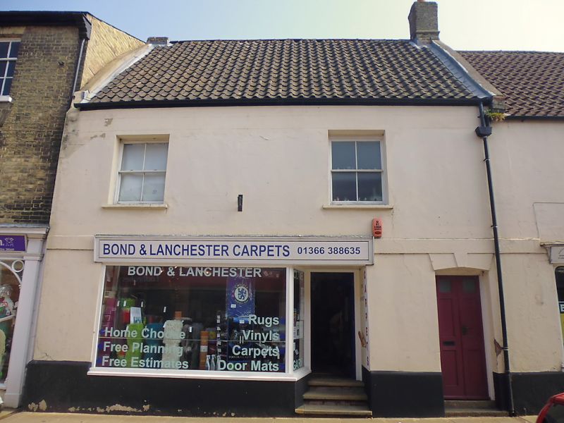
HIGH STREET
1. (East Side)
1051
No 5
TF 6O SW 2/42
II GV
2.
Early C18, 2 storey and attic, stucco lined and painted. 1st floor band,
plinth. 2 flush frame sash windows at 1st floor. 3-light gabled dormer casement.
Enlarged C19 shop window. Separate entrance right. Interior: hewn beams.
Nos 1 to 5 (odd) form a group.
Listing NGR: TF6114903148
External links are from the relevant listing authority and, where applicable, Wikidata. Wikidata IDs may be related buildings as well as this specific building. If you want to add or update a link, you will need to do so by editing the Wikidata entry.


Other nearby listed buildings
