Approximate Location Map
Large Map »
Latitude: 51.2273 / 51°13'38"N
Longitude: 1.4034 / 1°24'12"E
OS Eastings: 637720
OS Northings: 153072
OS Grid: TR377530
Mapcode National: GBR X1R.TYL
Mapcode Global: VHMDG.8FS0
Plus Code: 9F336CG3+W9
Entry Name: 116, Middle Street
Listing Date: 8 February 1974
Grade: II
Source: Historic England
Source ID: 1343709
English Heritage Legacy ID: 177204
ID on this website: 101343709
Location: Deal, Dover, Kent, CT14
County: Kent
District: Dover
Civil Parish: Deal
Built-Up Area: Deal
Traditional County: Kent
Lieutenancy Area (Ceremonial County): Kent
Tagged with: Building
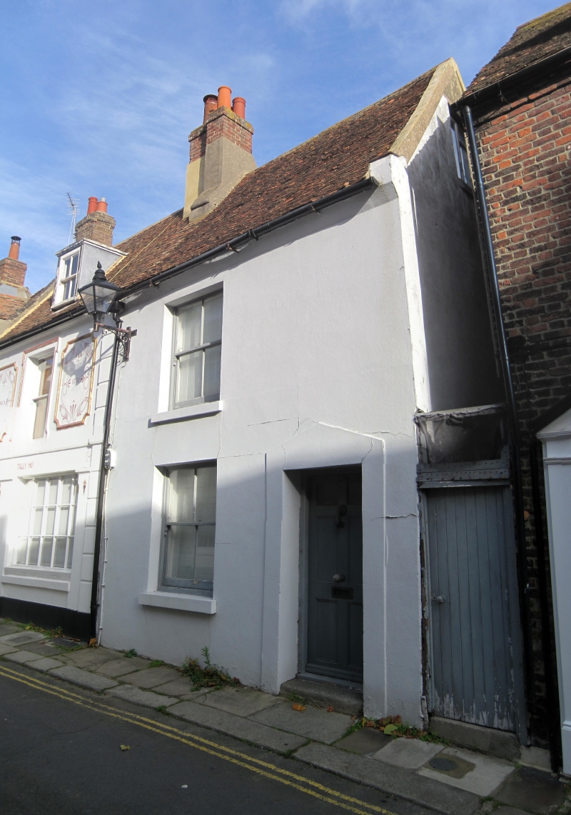
MIDDLE STREET
1.
1035
(East Side)
No 116
TR 3753 SE 2/354
II GV
2.
Mid C19. 2 storeys colour washed. 1 sash with verticals only and pediment-shaped
door surround. Included for group value.
Nos 110 to 126 (even) form a group.
Listing NGR: TR3772053072
External links are from the relevant listing authority and, where applicable, Wikidata. Wikidata IDs may be related buildings as well as this specific building. If you want to add or update a link, you will need to do so by editing the Wikidata entry.


Other nearby listed buildings
