Approximate Location Map
Large Map »
Latitude: 50.9084 / 50°54'30"N
Longitude: -0.5352 / 0°32'6"W
OS Eastings: 503081
OS Northings: 113129
OS Grid: TQ030131
Mapcode National: GBR GJS.X3N
Mapcode Global: FRA 96RP.Z5T
Plus Code: 9C2XWF57+9W
Entry Name: Malt House
Listing Date: 15 March 1955
Grade: II
Source: Historic England
Source ID: 1353929
English Heritage Legacy ID: 298233
ID on this website: 101353929
Location: Cross Gate, Horsham, West Sussex, BN18
County: West Sussex
District: Horsham
Civil Parish: Amberley
Built-Up Area: Amberley
Traditional County: Sussex
Lieutenancy Area (Ceremonial County): West Sussex
Church of England Parish: Amberley with North Stoke
Church of England Diocese: Chichester
Tagged with: House Malt house Thatched building
AMBERLEY CHURCH STREET
1. (south side)
5404
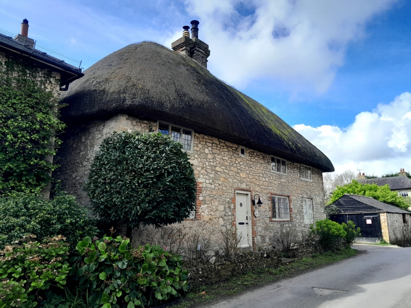
Malt House
TQ 0313 21/635 15.3.55 House
II GV
2.
C17 or earlier. Two storeys. Three windows. Stone rubble. Hipped thatched
roof. Casement windows with small square panes.
Listing NGR: TQ0308113112
External links are from the relevant listing authority and, where applicable, Wikidata. Wikidata IDs may be related buildings as well as this specific building. If you want to add or update a link, you will need to do so by editing the Wikidata entry.


Other nearby listed buildings
