Approximate Location Map
Large Map »
Latitude: 50.97 / 50°58'12"N
Longitude: -0.8804 / 0°52'49"W
OS Eastings: 478712
OS Northings: 119552
OS Grid: SU787195
Mapcode National: GBR CCS.089
Mapcode Global: FRA 961K.2VN
Plus Code: 9C2XX4C9+2V
Entry Name: Sunnyside Cottage
Listing Date: 26 November 1987
Grade: II
Source: Historic England
Source ID: 1354727
English Heritage Legacy ID: 301841
ID on this website: 101354727
Location: South Harting, Chichester, West Sussex, GU31
County: West Sussex
District: Chichester
Civil Parish: Harting
Built-Up Area: South Harting
Traditional County: Sussex
Lieutenancy Area (Ceremonial County): West Sussex
Church of England Parish: Harting St Mary and St Gabriel
Church of England Diocese: Chichester
Tagged with: Cottage
SU 7819-7919 HARTING THE SQUARE
South Harting
28/36 Sunnyside Cottage
II
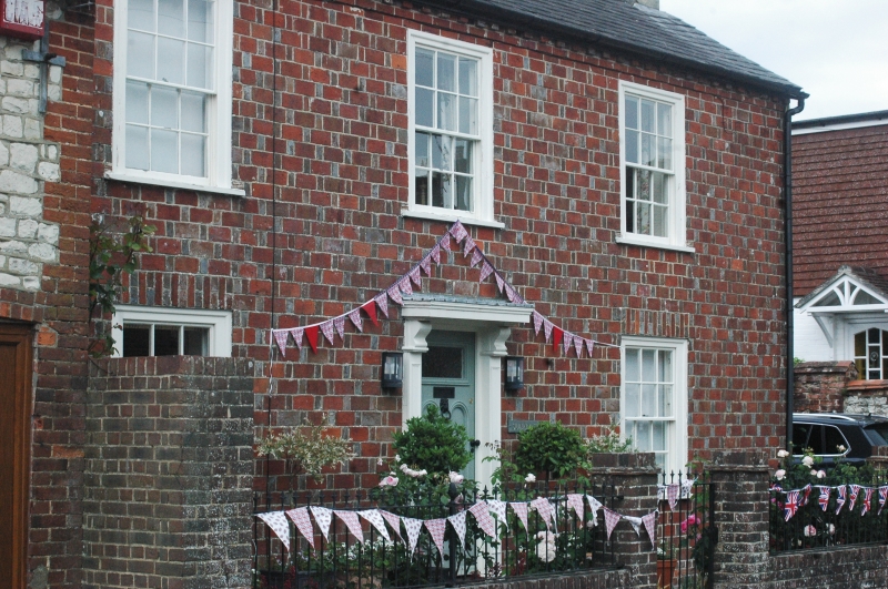
House. Early-Mid C19. Red brick and grey headers in rat-trap bond. Eaves
cornice. Slate roof. Glazing bars intact. Doorway with pediment. Two storeys.
Three windows. Empty and neglected.
Listing NGR: SU7871219552
External links are from the relevant listing authority and, where applicable, Wikidata. Wikidata IDs may be related buildings as well as this specific building. If you want to add or update a link, you will need to do so by editing the Wikidata entry.


Other nearby listed buildings
