Approximate Location Map
Large Map »
Latitude: 51.6441 / 51°38'38"N
Longitude: -1.8548 / 1°51'17"W
OS Eastings: 410140
OS Northings: 193930
OS Grid: SU101939
Mapcode National: GBR 3RV.ZVC
Mapcode Global: VHB2Z.SYS0
Plus Code: 9C3WJ4VW+J3
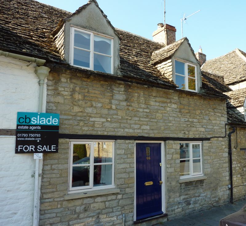
Entry Name: 66, High Street
Listing Date: 26 August 1976
Grade: II
Source: Historic England
Source ID: 1356065
English Heritage Legacy ID: 317803
ID on this website: 101356065
Location: Cricklade, Wiltshire, SN6
County: Wiltshire
Civil Parish: Cricklade
Built-Up Area: Cricklade
Traditional County: Wiltshire
Lieutenancy Area (Ceremonial County): Wiltshire
Church of England Parish: Cricklade
Church of England Diocese: Bristol
Tagged with: Building
SU 19 SW CRICKLADE HIGH STREET
(west side)
13/153 No. 66
26.8.76
GV II
House in row. C17 or C18. Limestone rubble. Stone slate roof.
Single storey and attic. Two bays. Central boarded door with wood
lintel continuous over flanking timber casement windows. Two
gabled flush dormers with 4-pane casements. Right gable stack.
Listing NGR: SU1013593931
External links are from the relevant listing authority and, where applicable, Wikidata. Wikidata IDs may be related buildings as well as this specific building. If you want to add or update a link, you will need to do so by editing the Wikidata entry.


Other nearby listed buildings
