Approximate Location Map
Large Map »
Latitude: 53.8779 / 53°52'40"N
Longitude: -2.7737 / 2°46'25"W
OS Eastings: 349231
OS Northings: 442686
OS Grid: SD492426
Mapcode National: GBR 9R2L.9M
Mapcode Global: WH850.CSFJ
Plus Code: 9C5VV6HG+5G
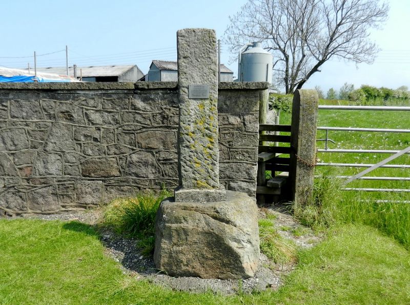
Entry Name: Cross
Listing Date: 9 January 1986
Grade: II
Source: Historic England
Source ID: 1361940
English Heritage Legacy ID: 185434
ID on this website: 101361940
Location: Nook, Wyre, Lancashire, PR3
County: Lancashire
District: Wyre
Civil Parish: Catterall
Traditional County: Lancashire
Lieutenancy Area (Ceremonial County): Lancashire
Church of England Parish: Garstang St Helen, Churchtown
Church of England Diocese: Blackburn
Tagged with: Monumental cross
CATTERALL A6
SD 44 SE
7/46 Cross
-
- II
Cross base, probably medieval, with shaft possibly a modern restoration.
Sandstone. Base an irregular boulder, now set on concrete. Shaft of
rectangular plan, cemented into socket in base.
Listing NGR: SD4923142686
External links are from the relevant listing authority and, where applicable, Wikidata. Wikidata IDs may be related buildings as well as this specific building. If you want to add or update a link, you will need to do so by editing the Wikidata entry.


Other nearby listed buildings
