Approximate Location Map
Large Map »
Latitude: 54.1464 / 54°8'47"N
Longitude: -2.7669 / 2°46'0"W
OS Eastings: 350005
OS Northings: 472557
OS Grid: SD500725
Mapcode National: GBR 9N3H.SD
Mapcode Global: WH83V.G1PM
Plus Code: 9C6V46WM+H7
Entry Name: 168, Main Street
Listing Date: 2 May 1968
Grade: II
Source: Historic England
Source ID: 1362459
English Heritage Legacy ID: 182011
ID on this website: 101362459
Location: Warton, Lancaster, Lancashire, LA5
County: Lancashire
District: Lancaster
Civil Parish: Warton
Built-Up Area: Warton
Traditional County: Lancashire
Lieutenancy Area (Ceremonial County): Lancashire
Church of England Parish: Warton St Oswald (or Holy Trinity)
Church of England Diocese: Blackburn
Tagged with: Building
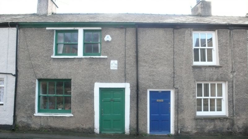
SD 57 SW WARTON MAIN STREET (EAST SIDE)
4/243 No. 168
2. 5. 1968
G.V. II
House, late C18th. Pebbledashed rubble with slate roof. 2 storeys. One
window on each floor, both 6-pane sashes. Front door of raised and fielded
panels with re-entrant corners, in a surround with plain reveals. Chimney
at right. Listed for group value.
External links are from the relevant listing authority and, where applicable, Wikidata. Wikidata IDs may be related buildings as well as this specific building. If you want to add or update a link, you will need to do so by editing the Wikidata entry.


Other nearby listed buildings
